Near Western Islands
About the Near Western Islands
The Near Western Islands comprise Badu, Mabuiag, Moa and Naghir Islands. The Near Western Island cluster has distinct cultural characteristics which define them as a region and people.
Badu is an island 60km north of Thursday Island in the Torres Strait. Warfare, turtle and dugong hunting were the main occupations of Badu men until the 1870s; turtle and dugong hunting continued after this. Pearlers established bases on the island during the 1870s and by the early 1880s the islanders were becoming dependent on wages earned as lugger crew. The language of Badu is Kala Lagaw Ya.
The language of Mabuiag is the Gœmulgau (Mabuylgau) Ya sub-dialect of Kala Lagaw Ya. Like the larger Moa and Badu Islands to its south, Mabuiag is part of the old submerged land bridge that ran from Cape York to Papua New Guinea. Mabuiag consists of two moieties, the Gumuligal of Wagadagam on the northwest side and the Mabuygilgal people of the Paipaidagam on the south-east side.
Moa is the second largest island in the Torres Strait. Kubin is a community located on Moa (Banks Island), which has two communities, Kubin and St Pauls. The language of Kubin is Kala Lagaw Ya (Muwalgau/Italgau and Kaiwalgau sub-dialects). Kubin residents retain their links with the Thursday Island (Waiben), Bamaga and Cowal Creek (Injinoo) communities. Poid was located on Moa and abandoned after World War II; one group moving back to their Narupai (Horn Island) homeland. The language of St Pauls is Brokan (Torres Strait Creole), though many people are bilingual in Kala Lagaw Ya. After the forced repatriation of Pacific Islander labourers, following the federal government's introduction of a restrictive immigration policy in 1904, the Queensland Government set aside a reserve on Moa's eastern shore for those who had married Torres Strait Islanders and Aboriginal people. In 1908 the Anglican Church began developing St Pauls Mission. St Pauls Community is located on the northern end of Moa (Banks Island).
These distinct cultural and geographical characteristics define the Near Western Islands as a region and people. The material listed in this section of the guide includes unpublished material such as letters, photographs, paintings and diaries referring to the Islands and people. Please note that individuals who were interviewed or photographed may not have been in the Near Western Island cluster when recorded.
Each Island has been categorised with related material which can be viewed in more detail by clicking on the related link to the Library's catalogue record. If a photo is included, a link will also be provided in its caption to its catalogue record.
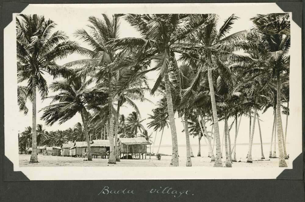
C. M. Yonge, The village seen through the palms, Badu Island, Queensland, ca. 1928, nla.gov.au/nla.obj-145055163
C. M. Yonge, The village seen through the palms, Badu Island, Queensland, ca. 1928, nla.gov.au/nla.obj-145055163
Badu - Mulgrave Island
Papers of Alan Marshall, 1903-1982 (MS404)
This manuscript contains two items of significance relating to the Island of Badu. The first being a picture of a young girl on the Island.
The second significance to Badu Island is a written recording of a story by Levi Madua retelling a story about Tutu Islanders (Eastern Islanders) and their Chief Kaigua war raid on Badu.
Album of views of the Torres Strait Islands, Queensland, 1928-1929 / Charles Maurice Yonge
This album contain 114 photographs and is part of the Great Barrier Reef Expedition, 1928-1929 photographic collection. The images capture aspects of everyday life for Islanders and include people who are yet to be identified. The following are a selection.
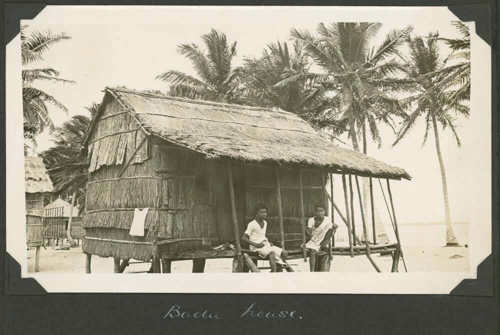
C. M. Yonge, A villager's hut, Badu Island, Queensland, ca. 1928, nla.gov.au/nla.obj-145055362
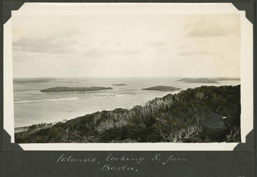
C. M. Yonge, Islands looking south from Badu Island, Queensland, ca. 1928, nla.gov.au/nla.obj-145050010
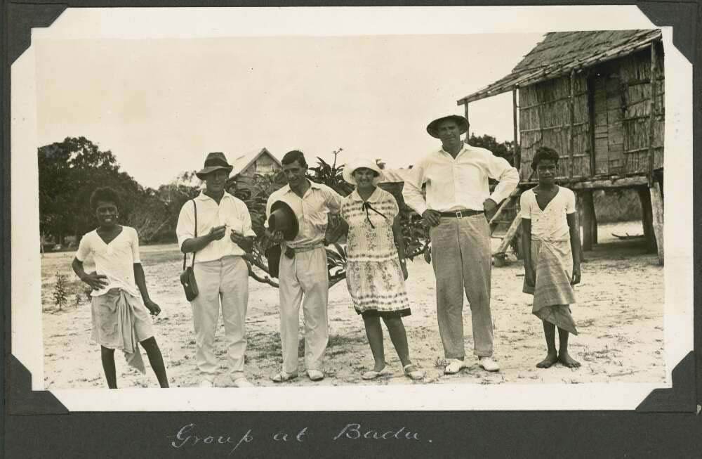
C. M. Yonge, Mattie Yonge and other expedition members, Badu Island, Queensland, ca. 1928, nla.gov.au/nla.obj-145056085
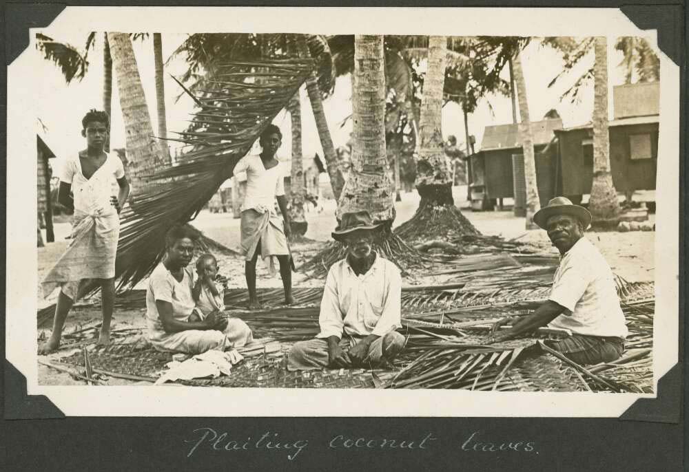
C. M. Yonge, Villagers plaiting the leaves from the coconut palms, Badu Island, Queensland, ca. 1928, nla.gov.au/nla.obj-145055667
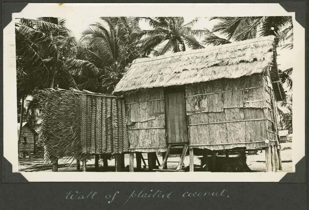
C. M. Yonge, A hut wall constructed of plaited leaves from coconut palms, Badu Island, Queensland, ca. 1928, nla.gov.au/nla.obj-145055865
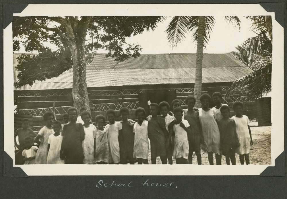
C. M. Yonge, Group of school children stand out the front of the school on Badu Island, Queensland, ca. 1928, nla.gov.au/nla.obj-145053110
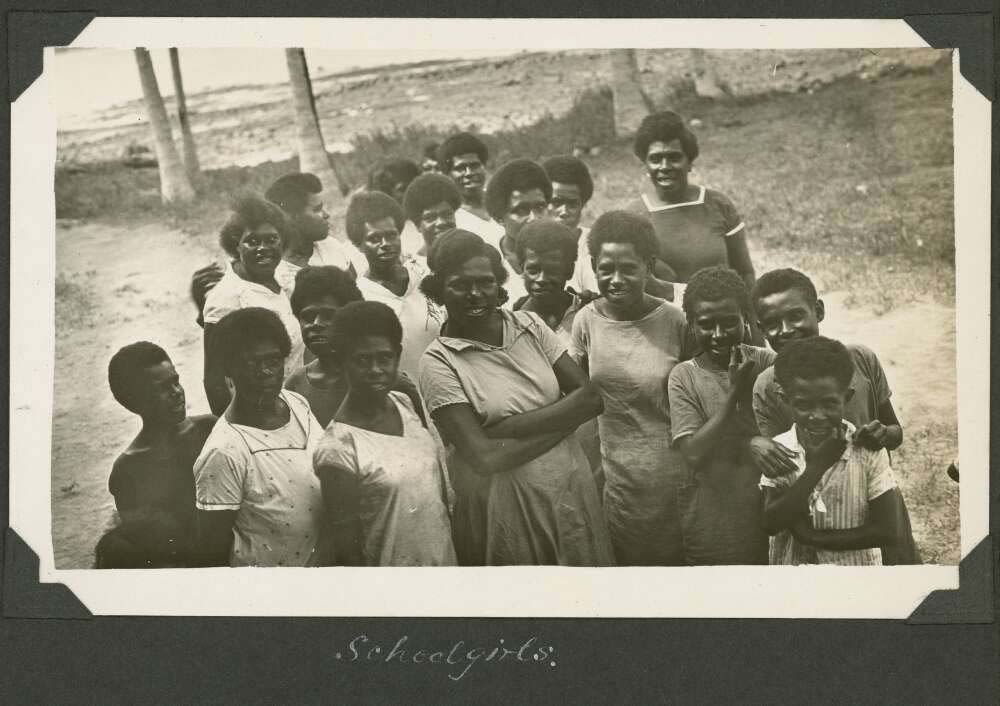
C. M. Yonge, Group of schoolgirls on Badu Island, Queensland, ca. 1928, nla.gov.au/nla.obj-145052316
Alick Tipoti interviewed by Karl Neuenfeldt in the Torres Strait songs project
Alick Tipoti is interviewed by Karl Neunfeldt in a Torres Strait Songs project. Tipoti discusses the necessity to speak language correctly and the medium of music to influence the more frequent use of language in the community.
Mabuiag - Jervis Island
Photograph album of Papua and the Torres Strait / Frank Hurley 1921
Frank Hurley (1885-1962) departed Sydney in December 1920 and spent three months among the islands of the Torres Strait. He traveled on to Papua via Daru Island and his visit to Papua lasted from 27 March to 19 August 1921. The islands in this album include Darnley, Mabuaig, Murray and the Thursday Islands and captures aspects of everyday life for Islanders. All of the images in this album are of people that are yet to be identified. The following three photographs are from this album.
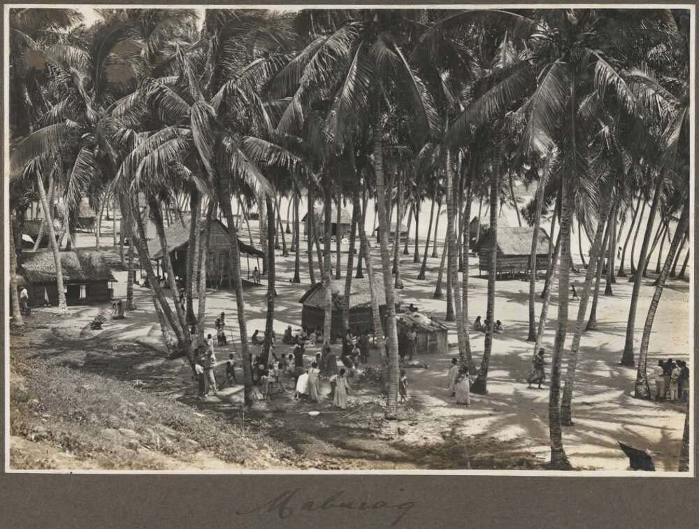
Frank Hurley, (1921), Mabuiag [view of village taken from a hill], nla.gov.au/nla.obj-149362475
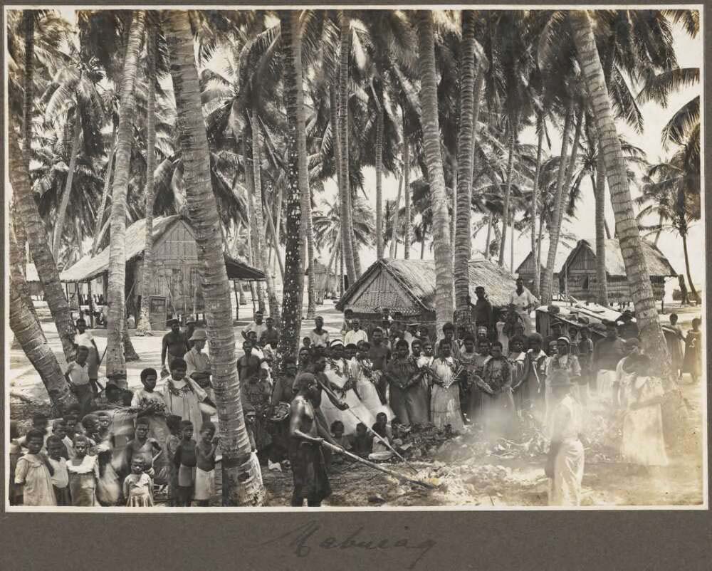
Frank Hurley, (1921), Mabuiag [village gathering], nla.gov.au/nla.obj-149362324
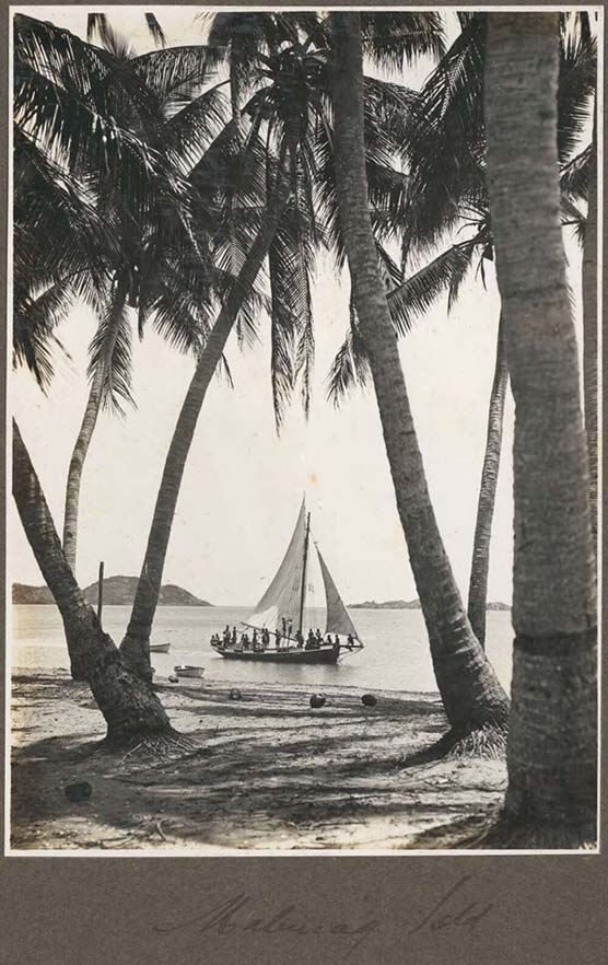
Frank Hurley, (1921), Mabuiag Island [view of sailing boat through palm trees], nla.gov.au/nla.obj-149361875
Moa - Banks Island
St Pauls Village
Papers of Dennis Newie, 1981-2009 (MS Acc11.082)
This manuscript comprises photographs and ephemera documenting the activities of the National Aboriginal and Islander Skills Development Association (NAISDA) Dance College, Aboriginal Islander Dance Theatre (AIDT) and other dance groups with which Dennis Newie danced and/or acted as choreographer, or unrelated dance groups which performed at events where he was present, between 1981 and 2009.
Arpaka Dance Group and Thursday Island infrastructure, Queensland, 2008
A collection of 18 digital photographs by Charles J. Page recording images of the Arpaka Dance group on Thursday Island in 2008. The following are two of those images.
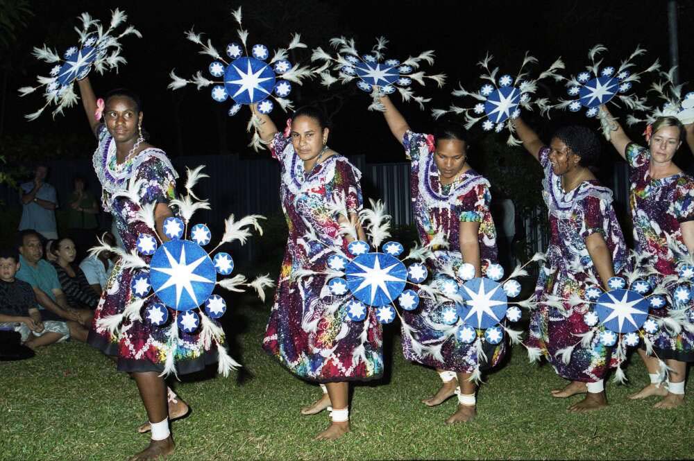
Charles J. Page, Torres Strait Island women performing a dance as part of the Arpaka Dance Group, Thursday Island, Queensland, 2008, nla.gov.au/nla.obj-148449394
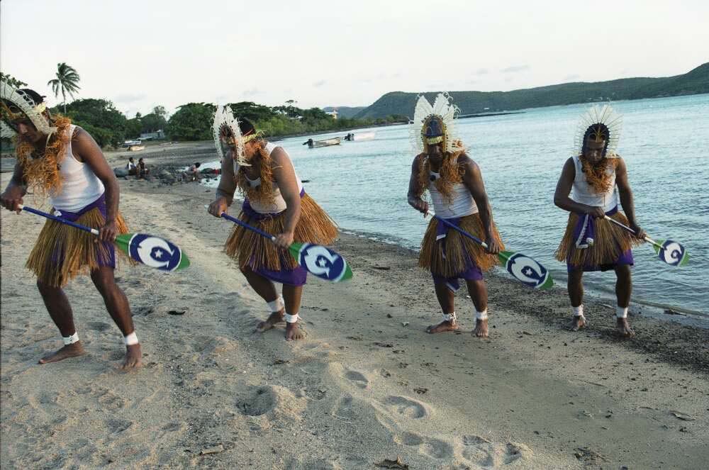
Charles J. Page, Torres Strait Island men performing a dance as part of the Arpaka Dance Group, Thursday Island, Queensland, 2008, 2, nla.gov.au/nla.obj-148449597
Dennis Newie interviewed by Lee Christofis
This oral history of Dennis Newie is digitised and available online. Newie Discusses his career as a dancer and growing up in a large Torres Strait Islander family. His influence of dance in his family but also his dancing career within Australia and globally. The development and establishment of dances and songs for his Dance Company Arparka group and St Pauls community.
In this guide
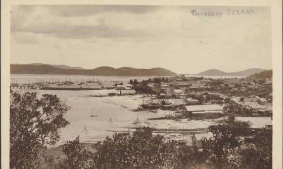
[View of the town and the pearling fleet in the harbour, with Prince of Wales Island on the left and Friday Island on the right], Thursday Island, [ca. 1917-1920], nla.gov.au/nla.obj-148874722
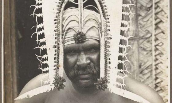
Frank Hurley, (1921), [Man wearing head dress], Darnley Island [Erub], Torres Straits, nla.gov.au/nla.obj-149360186
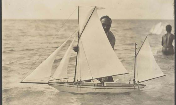
Frank Hurley, Islander with his model of a lugger, Coconut Island, Torres Strait, ca. 1925, nla.gov.au/nla.obj-140624777

Edward Mabo, (1964), Dauar and Waier Islands?, nla.gov.au/nla.obj-147043992