Improving desert fire management with culturally directed science
I am working with the rangers and Traditional Owners of Karajarri, Nyangumarta, Ngurrara and Ngururrpa to describe the fire patterns produced by traditional fire practice, by examining 80 year old aerial photographs of the Great Sandy desert. My project is at the invitation of four Indigenous Ranger Groups and their communities - the Ngurrara, Ngururrpa, Nyangumarta and Karajarri.
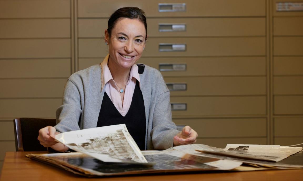
Stephanie Lee, 2025 National Library of Australia Scholar
Stephanie Lee, 2025 National Library of Australia Scholar
These ancestral territories are within the Great Sandy Desert in the Kimberly. Most people had left the region by the 1960s, with the last groups departing in the 1970s and a few by the early-1980s.
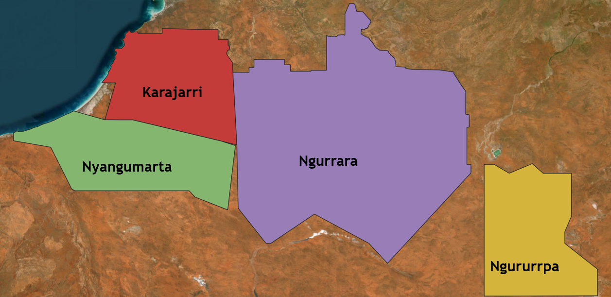
Great Sandy Desert project partners and Countries. Courtesy of Stephanie Lee.
Amongst our project partners, there are Elders who were brought up on Country with traditional lifestyles and who left as children or teenagers. These Elders are the living experts of traditional burning practices. However, most now face health challenges and find travel to remote parts of Country quite difficult or impossible.
Burning knowledge is passed on through practice rather than speaking in abstract terms. The usual transmission of practices has been disrupted, contributing to knowledge gaps. My research is aimed at providing information that can inform Indigenous rangers’ burning targets. The approach is to create maps from historical (1940/50s) aerial photographs and analyse the fire scars in these images, to identify the location and size of historic burns, as well as whether these appear to have been influenced by rainfall patterns.
Why is the reawakening of burning so compelling?
The loss of traditional burning for periods of 60-80 years has been devastating for the health of Country and people. One of the biggest impacts of the loss of burning is an increase in the scale of wildfires. For instance, the change in the fire regimes have contributed to the extinction of over 60% of the region’s native mammals.
Climate change is also exacerbating the frequency and intensity of wildfires. In 2023, wildfires in northern Australia burned approximately 84 million hectares of land, including over 18 million hectares across the Barkly, Tanami, and Great Sandy Deserts.
These are compelling reasons for reinstatement of fire management that can draw on millennia-old practices.
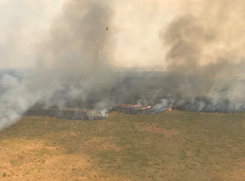
2017 wildfires in the Northern Australia region. Image credit: IDA.
Why come to the Library?
For First Nations communities of the northwestern deserts of Australia, the Library’s historical aerial photography collection provides insights on ancestral burning of Country. Most of the collection for this area dates to the late 1940s and early 1950s, a time when sizeable groups of people still lived traditionally on Country and burning was still active. Many of these photographs reveal fire scars.
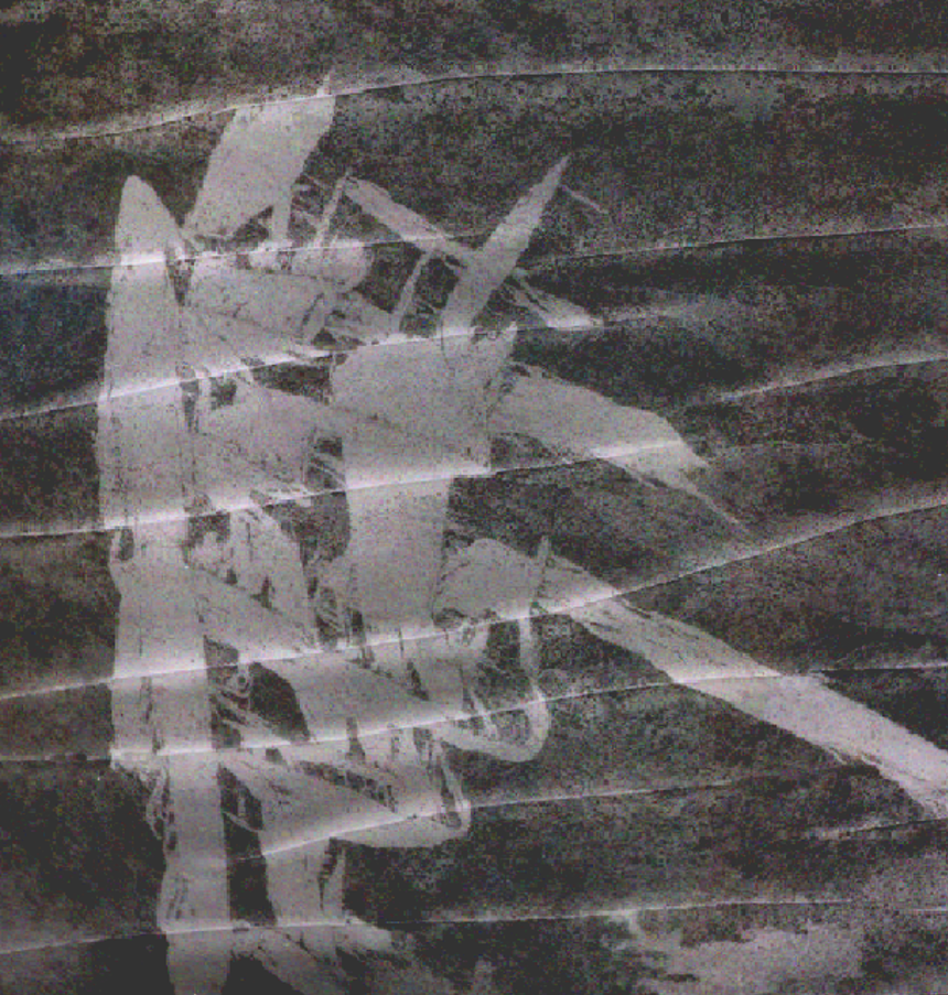
Karajarri Country fire scar, 1947. Image credit: ABC News.
Accessing the aerial photography collection was the central purpose of my scholarship placement. Driven by our project’s aims, I braced myself for the sluggish process of going through this enormous collection. Imagine for a moment my task of sifting through thousands of pieces of a puzzle, with no idea of what the bigger picture would be. Then imagine my delight when the Library’s expert staff guided me to a series of pre-made mosaics that I had no idea existed! Imagine these mosaics as huge chunks of the completed puzzle.
These mosaics also contain annotations: handwritten notes indicating wells and remains of the rabbit proof fence. These notes contain more layers of history that might spur conversation with Elders. These mosaics can be stitched together to provide a full picture of Country for each of the four communities.
The full maps may not have the resolution for the detailed analysis, but they do provide the index for selecting sites for investigation. My placement with the Library was a fantastic experience and I could not recommend it highly enough.
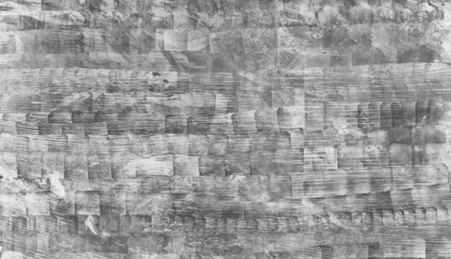
Georeferenced photographs from the National Library of Australia’s digitised collection. Compiled by Stephanie Lee.
Georeferenced photographs from the National Library of Australia’s digitised collection. Compiled by Stephanie Lee.
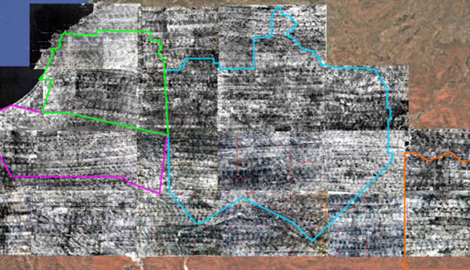
Georeferenced mosaics showing full maps of the partner communities, National Library of Australia’s digitised collection. Compiled by Stephanie Lee.
Georeferenced mosaics showing full maps of the partner communities, National Library of Australia’s digitised collection. Compiled by Stephanie Lee.
More to explore
Terry Milligan, Portrait of Judith Wright, c. 1998, nla.gov.au/nla.cat-vn1891350
Mark Jesser, European honey bees on a brood frame containing capped and uncapped cells at an apiary near Griffith, New South Wales, 2025, nla.gov.au/nla.obj-3668129443