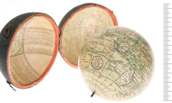
Maps | National Library of Australia (NLA)

Maps

Showing 37 - 47 of 47 results
A black and white map showing Australia, then called New Holland, in the late 1600s.
Two recently acquired Coronelli globe gores

The Library has recently acquired two 17th century globe gores by Vincenzo Coronelli.

News article
Japanese portrait of a women reading

Bijin Shinobazunoike o nozomu, Beauty looking at Shinobazu Pond (1895), nla.gov.au/nla.cat-vn5744665

Asian collections

The Asian language collections cover a broad range of formats and focus on contemporary Asia from the 19th century onwards 

Information article
Magazines and books from the 00s and 90s spread out, including the 'Australian Women's Weekly: Children's birthday cake book' and a document titled 'Y2K: State disaster contingency plan'
Discovery video: 90s and 00s nostalgia

Join Madeline and Allister as they dive into our collection and discover items from the '90s and '00s.

Video
Antique map showing a partial outline of Australia
Blaeu map added to the UNESCO Australian Memory of the World Register

The map includes details of the first sighting of Tasmania by Europeans and the first mapping of New Zealand.

News article
Screenshot showing part of the Port of Sydney in 1919
Map Search: Historical maps overlaid on modern maps

View historical maps overlaid on a modern map.

Information article
A group of men performing a traditional dance

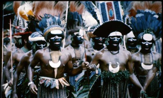
Terence & Margaret Spencer, Independence Day Celebration (15) Port Moresby, Papua New Guinea, 1975, nla.gov.au/nla.obj-145645567

Pacific collections

The National Library holds a rich and diverse range of library materials on the Pacific region, New Zealand and Papua New Guinea.

Information article
A 1920s map of Australia showing distribution of cattle and minerals

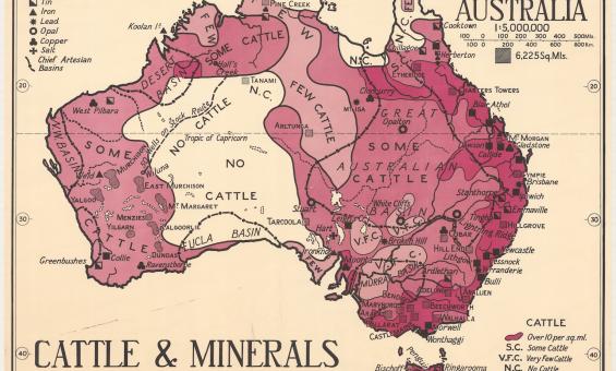
Thomas Griffith Taylor and H. O. Beckit, The new Oxford wall maps of Australia, c.1920, nla.gov.au/nla.obj-255201355

Rights and the Maps Collection

A summary of copyright and rights in the Maps Collection.

Information article
Highly decorative double hemispherical map of the world with the four elements depicted in each corner of the map

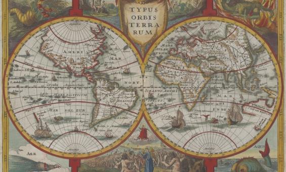
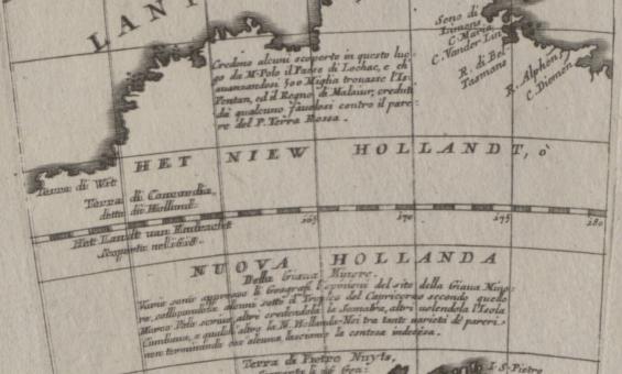
Jan Cloppenburgh, Typus orbis terrarum, 1673, nla.gov.au/nla.obj-231707274

Find the map you want

Learn how to find and explore the Library's vast and diverse online map collection.

Learning activity for adults
Video
Collection guide
Dalrymple Collection

Charts, plans, coastal views, letters, books, pamphlets and books relating to Alexander Dalrymple.

Collection guide
Collection guide
Sakakibara Collection

About 2600 books, mostly in Japanese including military works, biographies of the Japanese Royal Family and leading figures in Japan and Western countries, Chinese and Japanese classics and more.

Collection guide
Collection guide
Ferguson Collection

Over 32,000 items, including rare books, pamphlets, maps, and ephemera, covering topics such as Oceania, transport, and literature. Compiled by Sir John Alexander Ferguson, it is a key resource for Australian history and bibliography.

Collection guide

Need help?

Our librarians are here to guide you.

Ask a librarian