Australian cities | National Library of Australia (NLA)

Australian cities

Showing 13 - 15 of 15 results
Topographic map of Gordonvale, Queensland, showing contour lines, roads, rivers, and coastal areas, with military notations from 1942.

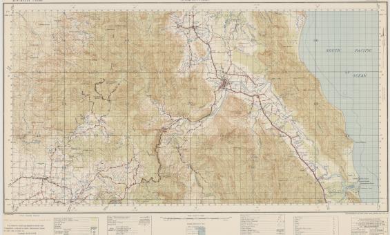
Australia. Army. Topographical Survey Company, 2/1st & Australia. Army. Topographical Survey Company, 6th & Australia. Army. Royal Australian Survey Corps. Gordonvale, Queensland Topographical Survey Company, 1942, nla.gov.au/nla.obj-234344829

Australian topographic maps research guide

We hold 200,000+ Australian topographic maps from 1900 onward. This guide helps you find current and historical maps at various scales in our collection.

Research guide
old map of Canberra

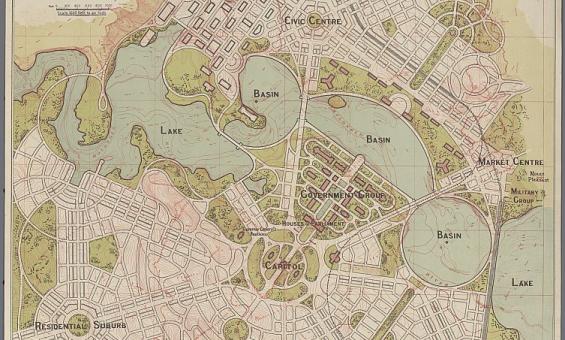
Walter Burley Griffin, Canberra Federal Capital of Australia preliminary plan, 1914, nla.gov.au/nla.obj-230041959

Federation: Focus on Canberra

In 1908 the Commonwealth Parliament passed the Seat of Government Act 1908, designating the Yass-Queanbeyan area for Australia's Capital Territory.

Research guide
Landscape watercolour showing trees, hilly, grass covered terrain, few small buildings and a mountain in the distance

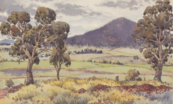
H M Rolland, Canberra, view from Camp Hill looking towards St. John' s Church, Mt. Ainslie in the distance, 1924, nla.gov.au/nla.obj-135217175

Canberra family history

Discover early family histories of the Canberra region while learning about how you too can explore your town and put your family history puzzle back together.

Learning activity for adults
Video

Need help?

Our librarians are here to guide you.

Ask a librarian