Australian topographic maps research guide
What information is in topographic maps
A topographic map provides a visual reference to the layout of a landscape. It represents the natural and made environment using a system of measurement (scale), grid, references and symbols. Use this guide to discover how to find topographic maps in our collection.
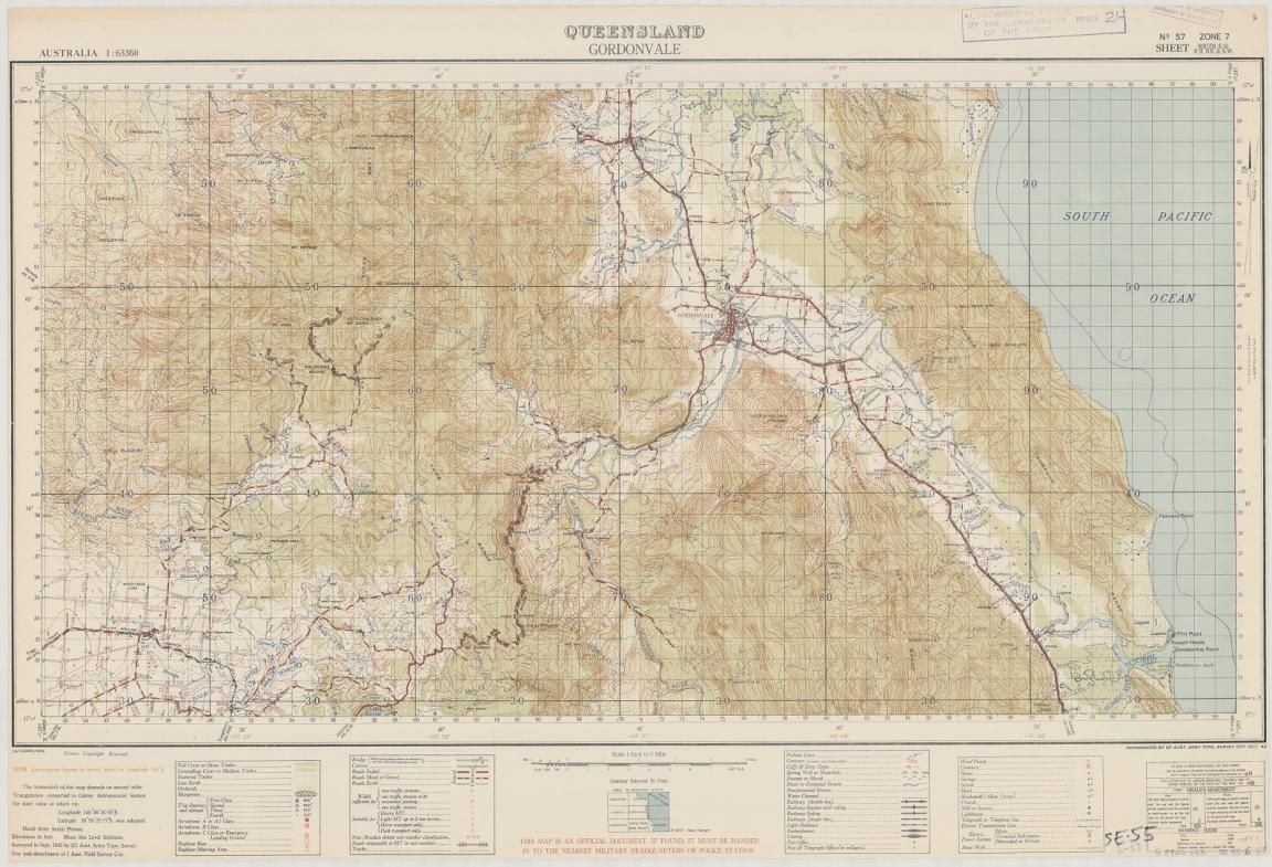
Australia. Army. Topographical Survey Company, 2/1st & Australia. Army. Topographical Survey Company, 6th & Australia. Army. Royal Australian Survey Corps. Gordonvale, Queensland Topographical Survey Company, 1942, nla.gov.au/nla.obj-234344829
Australia. Army. Topographical Survey Company, 2/1st & Australia. Army. Topographical Survey Company, 6th & Australia. Army. Royal Australian Survey Corps. Gordonvale, Queensland Topographical Survey Company, 1942, nla.gov.au/nla.obj-234344829
It can be used to explore the sense of a place; and its relationships to other places, including changes over time. A topographic map may include a variety of detail, including contours and elevation, forested areas, water courses and roads. In this way, topographic maps can be used to build a picture of human activity and changing landscapes.
Topographic maps are usually published as a series at a given scale, for a specific area. A map series comprises a large number of map sheets fitting together like a giant jigsaw puzzle, to cover a large area in a lot of detail.
Maps in the collection
Current mapping (1960 to present)
The 1:100 000 national topographic series gives a good general overview.
For highly detailed mapping of more densely settled areas, use the 1:25 000 series or the 1:50 000 series.
Smaller scale mapping provides a view of large areas of the country on each sheet, for example the 1:250 000 series, 1:500 000 series, and 1:1 000 000.
Australia 1:1 000 000
Australia 1:250 000
Australia 1:100 000
Australia 1:50 000
Historical mapping (pre-1960)
Australian topographic maps published in the 1960s or earlier used one of a number of imperial scales. A standard series for historical mapping enquiries is the inch:mile (1:63 360). Series at one inch: 4 miles (1:253 440) and one inch: 2 miles (1:126 720) are also available.
Australia 1:63 360
Australia 1:506 880
Australia 1:253 440
Australia 1:126 720
State based series
Large-scale (detailed) mapping is usually undertaken by state-based authorities.
NSW 1:25 000
QLD 1:25 000
SA 1:25 000
TAS 1:25 000
VIC 1:25 000
WA 1:25 000
How to find topographic maps
To locate post-1900 topographic maps of Australia, follow these steps.
Search the catalogue
Indexes for all Australian topographic series are available online. You can search the catalogue to find the relevant series.
- Search the catalogue using keywords like "Australia," "topographic," and the scale.;
- Select the format 'Map' from the 'Limit your Search' drop down menu.
- Select the appropriate series from the search results.
- Use the online index to identify the sheet(s) of interest.
- Click 'Request' or scroll to the ‘Request this item’ box and log in.
- Specify the map sheet(s) you need, such as “SD52”.
Search tip
For specific scales, include the name of the state and the scale as a keyword when you search the catalogue.
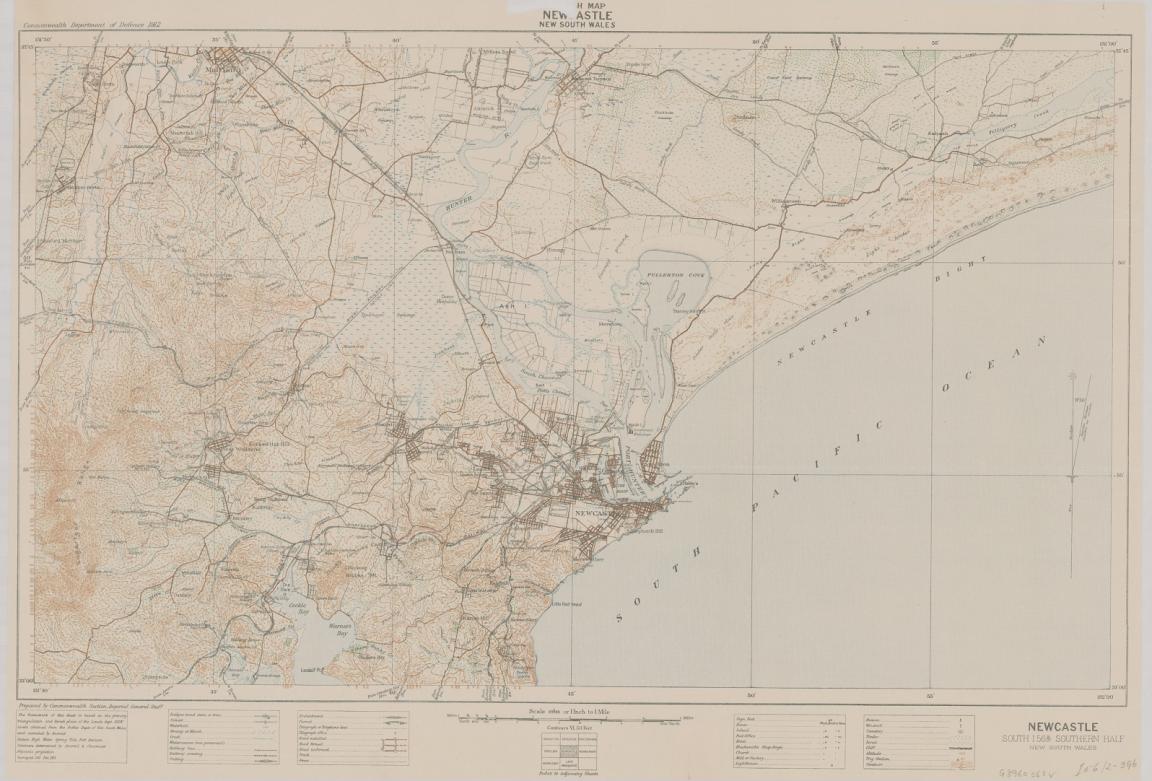
Great Britain. War Office. General Staff. Commonwealth Section, cartographer & Australia. Department of Defence, Sketch map Newcastle, New South Wales, 1913, nla.gov.au/nla.obj-234346718
Great Britain. War Office. General Staff. Commonwealth Section, cartographer & Australia. Department of Defence, Sketch map Newcastle, New South Wales, 1913, nla.gov.au/nla.obj-234346718
Example search results:
- Australia AND topographic AND 1000000 with format 'Map'
- Australia AND topographic AND 63360 with format 'Map'
- New South Wales AND topographic AND 25000 with format 'Map'
Note: Most series indexes display the scale, call number, and series title or serial number. If coordinates are not clear, use a general map or atlas to approximate the location.
Visit the Library
Visit the Special Collections Reading Room to access map series indexes.
- Select the appropriate series index to find the map sheet(s) for your location of interest.
- Locate the Bib ID on the index and enter it into the online catalogue.
- Find the map record by clicking the title in the search results.
- Go to the bottom of the record and select 'Request'.
- Specify the map sheet(s) you want to view, such as “SD52”.
Where else to look
Geoscience Australia is the national mapping agency. They provide a searchable database of Australian places. You can use the database as an alternative method of identifying topographic map sheet numbers.
Search for your place of interest, click on an appropriate record and note the sheet numbers (tip: look for "Map 100K"), as shown below for Young, NSW.
Get help with your research
Our specialist staff can help you with your research, to locate resources and to use our microform and scanning equipment but they cannot undertake extensive or ongoing genealogical, historical or other research on your behalf.
Find out more in our Information and Research Policy.
Continue your journey


More to explore
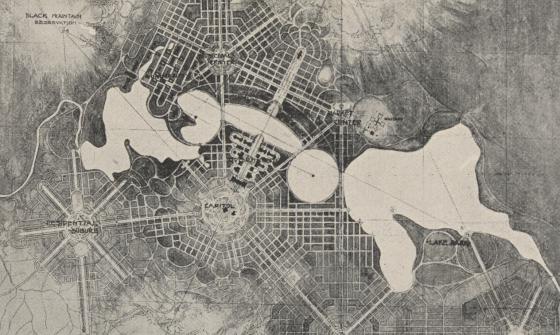
Detail of a black and white foolscap offprint of 'City and Environs, a plan of Canberra' from the papers of Walter Burley Griffin and Marion Mahony collected by Eric Nicholls, nla.gov.au/nla.obj-3210431032

Bijin Shinobazunoike o nozomu, Beauty looking at Shinobazu Pond (1895), nla.gov.au/nla.cat-vn5744665
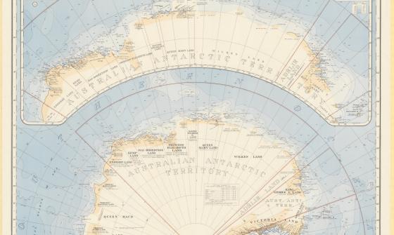
Australia. Department of the Interior. Property and Survey Branch. & E. P. Bayliss, J. S. & Cumpston, Antarctica, 1939, nla.gov.au/nla.obj-236895938
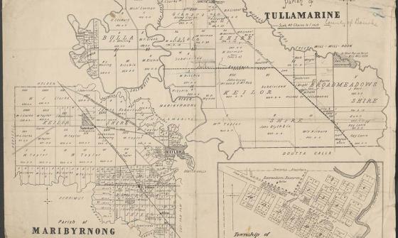
Parish of Tullamarine Parish of Maribyrnong, 1892, nla.gov.au/nla.obj-232027555