Real estate or sales plans
Real estate companies used sales plans to advertise land sales, both those that occurred and some that did not progress further than the plan.
They contain evidence of prices paid for suburban blocks, boundaries, road changes, land use, social change and types of ownership.
How to search, find and access items
Our collection of 10,000 sales plans records the real estate auctions of eastern Australia, including Sydney, and the subdivision of vast tracts of land, from the 1840s to the 1930s.
Many can be viewed online, and all can be viewed at the Library.

Hardie & Gorman Pty. Ltd, Circular Quay and George St., a splendid site for stores and offices, opposite the wharves for auction sale at the rooms, 133 Pitt St, 1900, nla.gov.au/nla.obj-230508873
Hardie & Gorman Pty. Ltd, Circular Quay and George St., a splendid site for stores and offices, opposite the wharves for auction sale at the rooms, 133 Pitt St, 1900, nla.gov.au/nla.obj-230508873
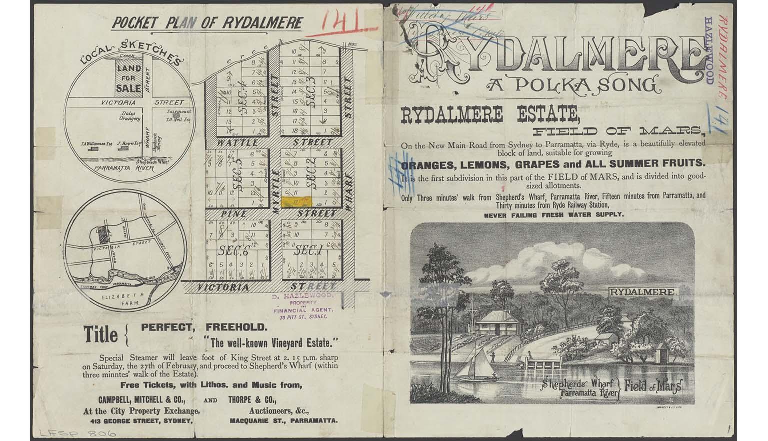
Campbell, Mitchell & Co. & Thorpe & Co., Pocket plan of Rydalmere, 1886, nla.gov.au/nla.obj-230181089
Campbell, Mitchell & Co. & Thorpe & Co., Pocket plan of Rydalmere, 1886, nla.gov.au/nla.obj-230181089
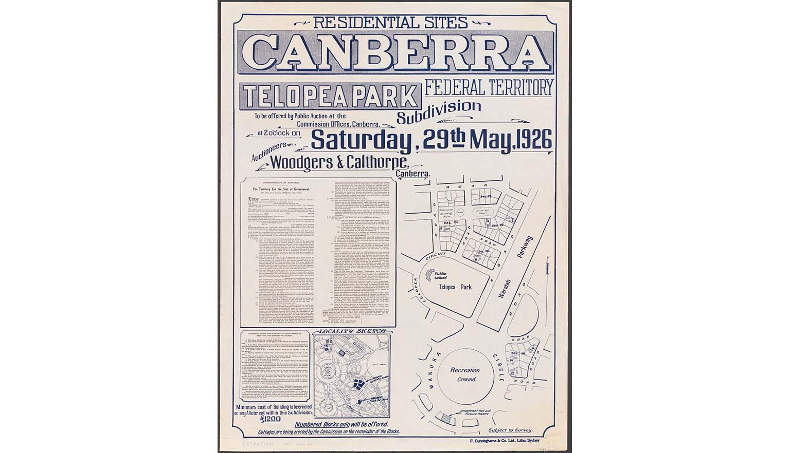
Federal Capital Commission & Woodgers & Calthorpe Ltd., Residential sites Canberra Federal Territory, Telopea Park, subdivision, 1926, nla.gov.au/nla.obj-232879045
Federal Capital Commission & Woodgers & Calthorpe Ltd., Residential sites Canberra Federal Territory, Telopea Park, subdivision, 1926, nla.gov.au/nla.obj-232879045

Hardy, Busby & Norman & H. McWilliam, Tuross between Bodalla & Moruya for private sale H.R. McWilliam, Property Salesman, 1924, nla.gov.au/nla.obj-229906993
Hardy, Busby & Norman & H. McWilliam, Tuross between Bodalla & Moruya for private sale H.R. McWilliam, Property Salesman, 1924, nla.gov.au/nla.obj-229906993
Search the catalogue
- Search the catalogue for “sales plan” AND a place, town or suburb name.
- For example, sales plan AND circular quay
- From the Limit your search options on the right-hand side, select Format, then Maps.
- To view only digitised maps, use the Limit your search options to select Access, then National Library (digitised item).
Request to view the map at the Library
If the map you want is not digitised, you can request to view it in the Library.
You will need to join the Library if you want to access our special collections materials in-person. Joining is free and allows you to request collection items to use in the Library, as well as providing access to a wide range of eResources you can access from home.
To request a map
- Find a map in the catalogue and open the catalogue record
- Click the Request button at the top of the record
- Click the Select button to select a copy
- Log in to your Library account
- Click on the Request button to confirm your request.
Once requested, maps are delivered to the Special Collections Reading Room for viewing.
How to order copies of maps
Once you have identified maps of interest, you can order copies of material using our Copies Direct service.
For further information, see: Copies and loans
Maps and copyright
Maps are usually published items.
- Maps published in or before 1954 are out of copyright.
- Maps published in 1955 or later by a government publisher: copyright lasts for 50 years after the end of the year the map was published.
- Maps published in 1955 or later by a non-government publisher: copyright lasts for 70 years after the end of the year the map was published.
For further information, see: Rights and the Maps Collection.
Get help with your research
Our specialist staff can help you with your research, to locate resources and use our microform and scanning equipment but they cannot undertake extensive or ongoing genealogical, historical or other research on your behalf.
Find out more in our Information and research services policy.
Continue your journey


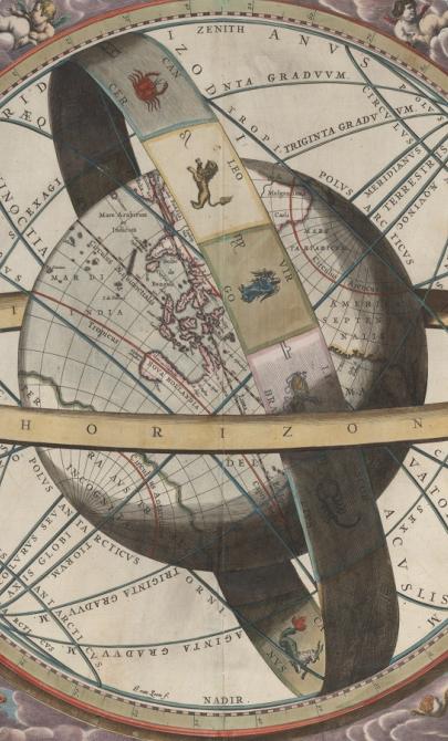
J. van. Loon & Andreas Cellarius, Sitvs terrae circvlis coelestibvs circvndatae, 1660, nla.gov.au/nla.obj-230714394
More to explore
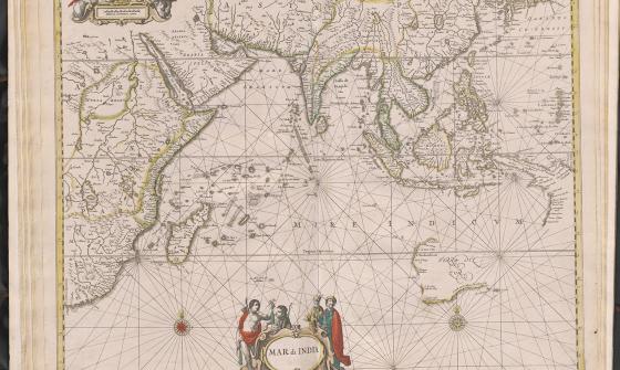
Jan Jansson & Hendrick Doncker, Mar di India, 1659, nla.gov.au/nla.obj-230757141
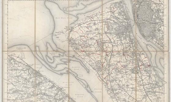
New one inch Ordnance Survey of England & Wales, 1864, nla.gov.au/nla.obj-231933519
This ‘one inch’ topographic map has a scale of one inch on the map representing one mile on the ground (1:63 360). Ordnance Survey maps at this scale provide an overview of an area, including the relationships between cities, villages and other features in the landscape.

[Anderson family children on a garden seat at Dee Why, New South Wales], c. 1920, nla.obj-145928313