Pastoral or squatting maps
How to search, find and access items
Many of our maps can be viewed online, and all can be viewed at the Library.
Search the catalogue
- Search the catalogue for the relevant state name and add the words 'AND pastoral OR squatting'.
- Tip: Use "inverted commas" to search by a state name as a phrase
- For example: "New South Wales" AND pastoral OR squatting
- From the Limit your search options on the right-hand side, select Format, then Maps.
- Sort the results by Date Old to New, or select from a Limit your search by Year Range.

Thomas Ham, Blundell and Ford, The squatting map of Victoria, 1864-1865, nla.gov.au/nla.obj-231392173
This squatting map of Victoria shows counties, road and rail lines, settlements and subdivisions. Relief is shown on the map using hachures.
Thomas Ham, Blundell and Ford, The squatting map of Victoria, 1864-1865, nla.gov.au/nla.obj-231392173
This squatting map of Victoria shows counties, road and rail lines, settlements and subdivisions. Relief is shown on the map using hachures.
Identify a pastoral property
- Most of the early pastoral maps have been digitised and can be viewed online.
- Zoom in on the map to identify pastoral property and squatting run names.

Reuss & Browne's map of New South Wales and part of Queensland shewing the relative positions of the pastoral runs, squattages, districts, counties, towns, reserves &c, 1860, (detail) nla.gov.au/nla.obj-230694679
Reuss & Browne's map of New South Wales and part of Queensland shewing the relative positions of the pastoral runs, squattages, districts, counties, towns, reserves &c, 1860, (detail) nla.gov.au/nla.obj-230694679
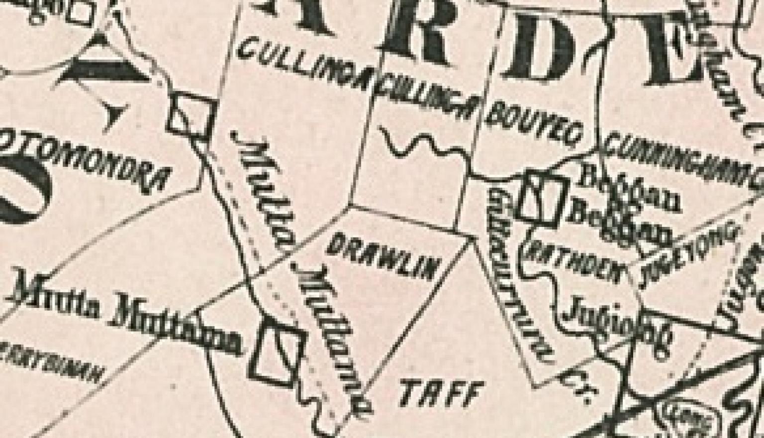
Reuss & Browne's map of New South Wales and part of Queensland shewing the relative positions of the pastoral runs, squattages, districts, counties, towns, reserves &c, 1860, (detail) nla.gov.au/nla.obj-230694679
Reuss & Browne's map of New South Wales and part of Queensland shewing the relative positions of the pastoral runs, squattages, districts, counties, towns, reserves &c, 1860, (detail) nla.gov.au/nla.obj-230694679
Request to view a map at the Library
If the map you want is not digitised, you can request to view it in the Library.
You will need to join the Library if you want to access our special collections materials in-person. Joining is free and allows you to request collection items to use in the Library, as well as providing access to a wide range of eResources you can access from home.
To request a map
- Find a map in the catalogue and open the catalogue record
- Click the Request button at the top of the record
- Click the Select button to select a copy
- Log in to your Library account
- Click on the Request button to confirm your request.
Once requested, maps are delivered to the Special Collections Reading Room for viewing.
How to order copies of maps
Once you have identified maps of interest, you can order copies of material using our Copies Direct service.
For further information, see: Copies and loans
This map of Queensland shows 12 land districts, with detail of individual squatting runs. The land districts persist to this day (albeit both Gregory and Kennedy have been split into North and South).
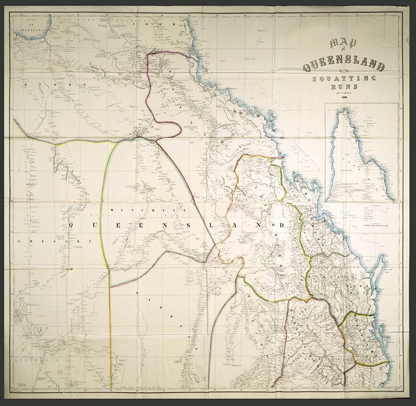
W Owen & H Bolton, Map of Queensland with squatting runs, 1866, nla.gov.au/nla.obj-232310944
This map of Queensland shows 12 land districts, with detail of individual squatting runs. The land districts persist to this day (albeit both Gregory and Kennedy have been split into North and South).
W Owen & H Bolton, Map of Queensland with squatting runs, 1866, nla.gov.au/nla.obj-232310944
This map of Queensland shows 12 land districts, with detail of individual squatting runs. The land districts persist to this day (albeit both Gregory and Kennedy have been split into North and South).
Featured resource
Consult Bailliere’s gazetteer
Bailliere’s gazetteers, published for each colony in the 1860s and 1870s, refer to and describe many localities and pastoral stations.
These gazeteers are available on request through the catalogue.
- For example, search for “New South Wales” AND Bailliere’s gazetteer
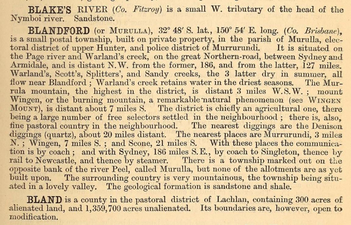
Bailliere's New South Wales gazetteer and road guide : containing the most recent and accurate information as to every place in the colony : with map / compiled by Robt. P. Whitworth, 1866, (detail) nla.gov.au/nla.cat-vn702998
Bailliere's New South Wales gazetteer and road guide : containing the most recent and accurate information as to every place in the colony : with map / compiled by Robt. P. Whitworth, 1866, (detail) nla.gov.au/nla.cat-vn702998
Maps and copyright
Maps are usually published items.
- Maps published in or before 1954 are out of copyright.
- Maps published in 1955 or later by a government publisher: copyright lasts for 50 years after the end of the year the map was published.
- Maps published in 1955 or later by a non-government publisher: copyright lasts for 70 years after the end of the year the map was published.
For further information, see: Rights and the Maps Collection.
Get help with your research
Our specialist staff can help you with your research, to locate resources and use our microform and scanning equipment but they cannot undertake extensive or ongoing genealogical, historical or other research on your behalf.
Find out more in our Information and research services policy.
Continue your journey


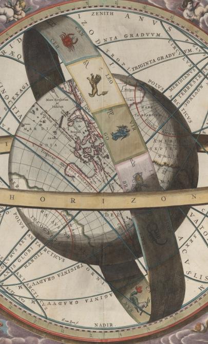
J. van. Loon & Andreas Cellarius, Sitvs terrae circvlis coelestibvs circvndatae, 1660, nla.gov.au/nla.obj-230714394
More to explore
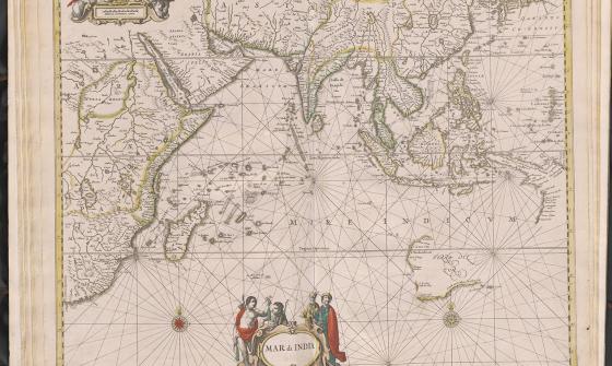
Jan Jansson & Hendrick Doncker, Mar di India, 1659, nla.gov.au/nla.obj-230757141
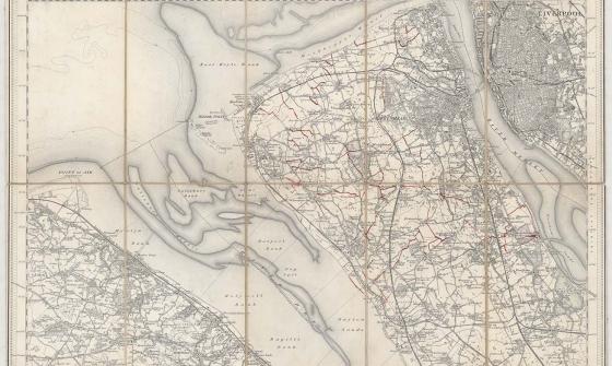
New one inch Ordnance Survey of England & Wales, 1864, nla.gov.au/nla.obj-231933519
This ‘one inch’ topographic map has a scale of one inch on the map representing one mile on the ground (1:63 360). Ordnance Survey maps at this scale provide an overview of an area, including the relationships between cities, villages and other features in the landscape.

[Anderson family children on a garden seat at Dee Why, New South Wales], c. 1920, nla.obj-145928313