Aerial photography research guide
What information is in aerial photographs
Historic aerial photography allows researchers to view a landscape, town or even a building from the air, as it was at a particular point in time.
You can use our collection of aerial photographs for a wide range of activities, including:
- land and water management
- urban planning
- ecology
- archaeology
- military research .
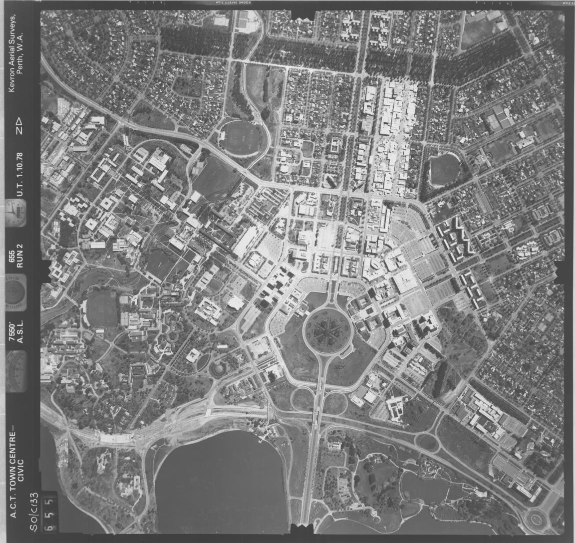
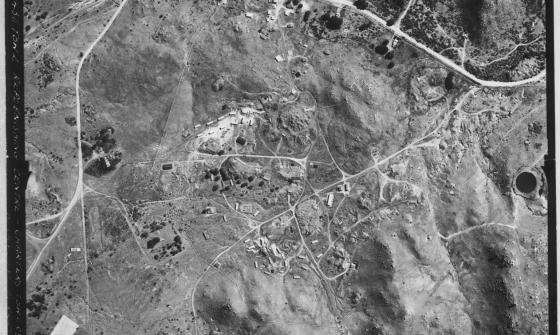
ACT town centre - Belconnen, Woden, Civic, 1978, nla.gov.au/nla.obj-2455089225
ACT town centre - Belconnen, Woden, Civic, 1978, nla.gov.au/nla.obj-2455089225
We also hold some photography of Papua New Guinea and East Timor, and a large collection covering Antarctica. To access the PNG, East Timor or Antarctic collections, contact us via Ask a Librarian.
How to find aerial photographs
Most catalogue records for aerial photographs have a flight diagram attached. To see the flight diagram click on the ‘Related Online Resources – Trove’ link on a catalogue record. Printed copies of flight diagrams are available in the Special Collections Reading Room. Flight diagrams are produced alongside aerial photography, and provide information about the flight path of the pilot and the points at which photographs were taken.
Flight diagrams show the height and the approximate area covered by each photograph divided into “runs”. A run is the flight path of the plane as it photographed the area below.
Use the flight diagram (where applicable) to ascertain whether a particular series of photographs covers your area of interest.
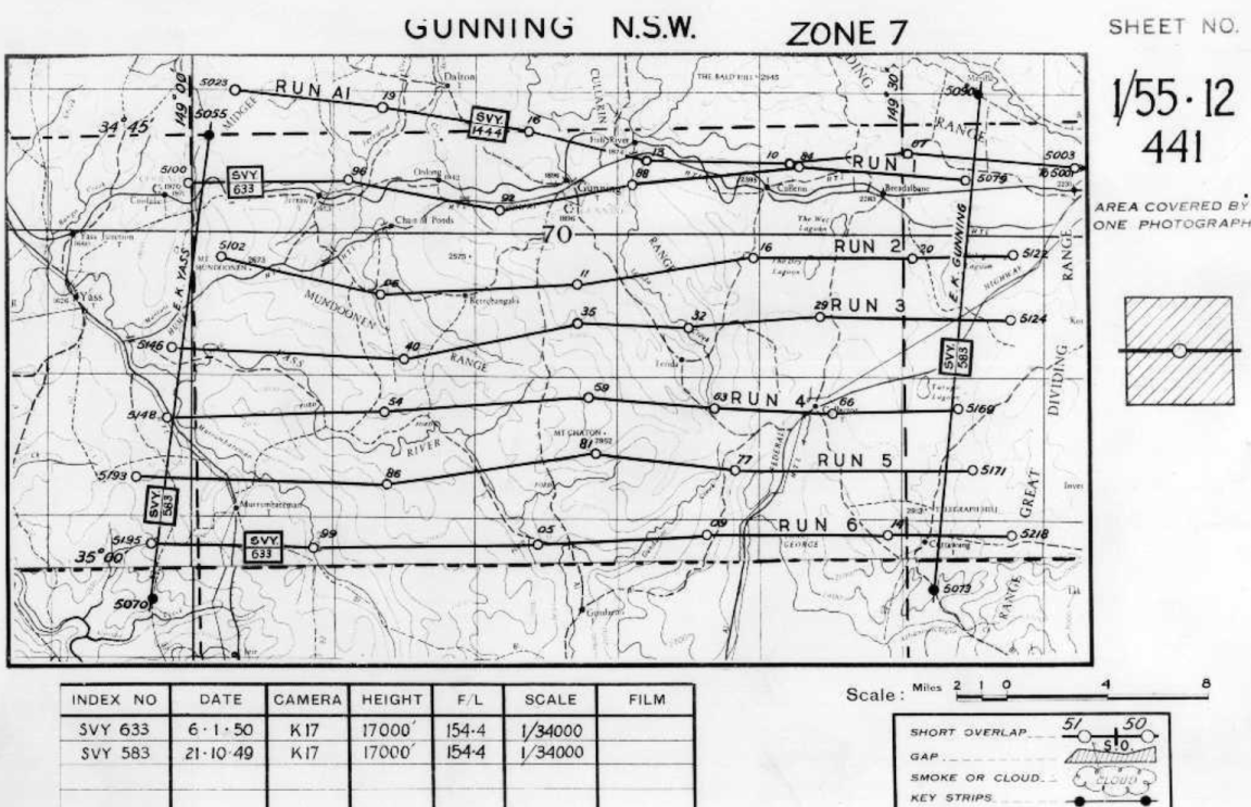
Flight diagram for Gunning aerial photographs I 55 12 441, 1950, nla.gov.au/nla.cat-vn4329526
Flight diagram for Gunning aerial photographs I 55 12 441, 1950, nla.gov.au/nla.cat-vn4329526
Search tip
The grid numbers used to catalogue aerial photography in our collection are part of a larger grid that covers the whole country based on the Imperial measure four mile to one inch (1:243,440 scale) and one mile to one inch (1:63,360 scale) topographic map sheet areas. Indexes for both the four mile map series and one mile maps series shows these sheet areas. All of Australia’s aerial photography fits between C 49 and K 56. For assistance in determining the grid numbers you can contact Ask a Librarian.
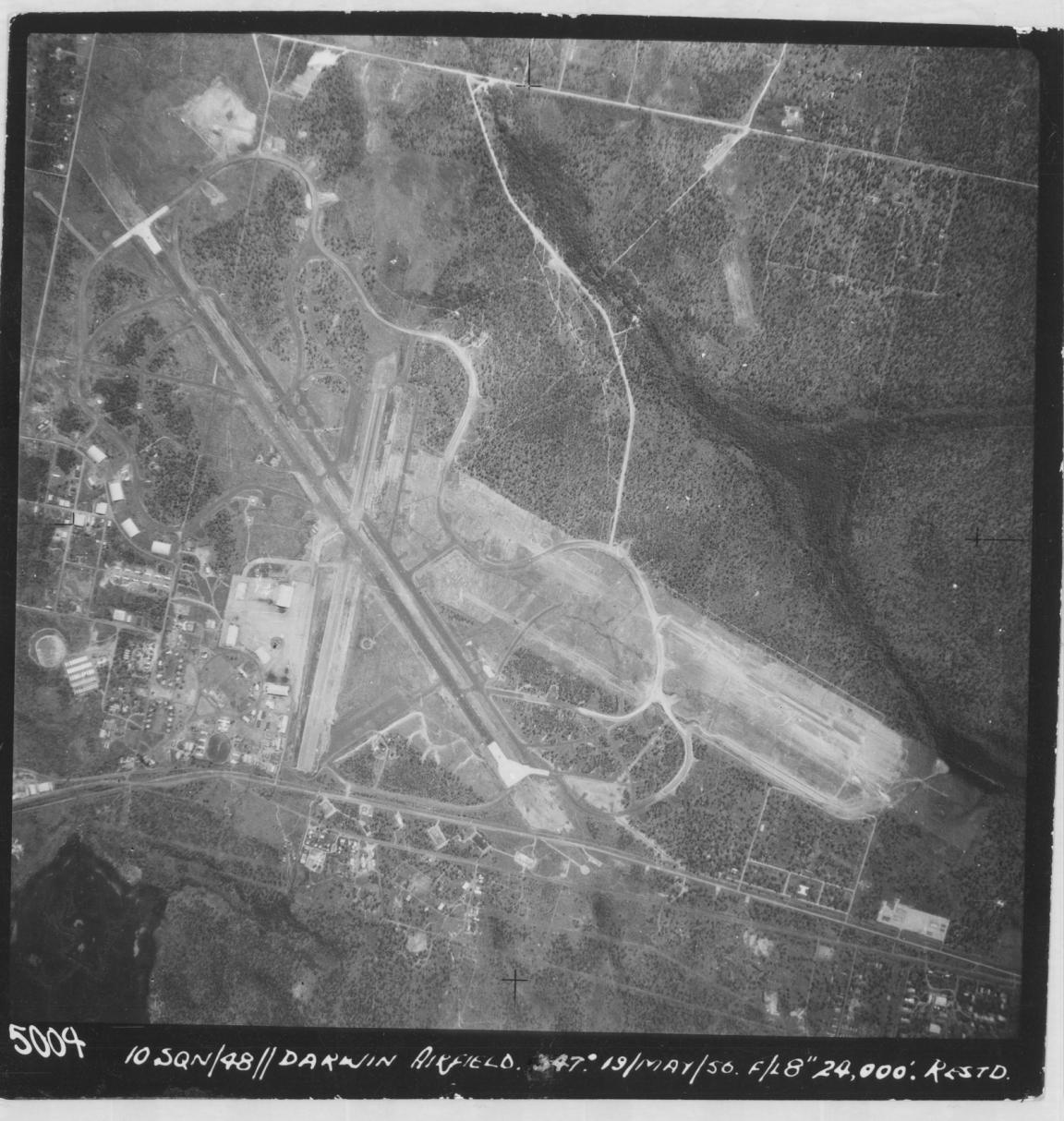
Darwin Airfield, 1956, nla.gov.au/nla.obj-743654647
Darwin Airfield, 1956, nla.gov.au/nla.obj-743654647
Major towns and airfields
Find and request aerial photography of a major town or airfield.
Search our catalogue using the place name and “aerial photographs” in the search bar, and on a results list Limit your search by the Format of Map.
Use flight diagrams to identify photographs covering your area of interest.
Smaller towns, places and sites
You will need to identify the topographic map sheet number for your area of interest for smaller towns, more obscure places, and study sites defined by geographic features or coordinates.
To find Australian imagery, follow these steps. For imagery of Papua New Guinea or other countries, Ask a Librarian.
Step 1: Find the places grid reference or sheet number
- Use the sheet indexes for the Imperial measure four mile to one inch (1:243.440 scale) or one mile to one inch (1:63,360 scale) topographic map series to locate the sheet number the place is in
- Example: Bourke is H 55 10 in the four mile series and H 55 10 540 in the one mile series.
Step 2: Search by call number
- Use the catalogue Advanced Search to search by call number
- Enter ‘Map aerial photograph collection’ and the sheet number the place is in and search
- For example: for Bourke enter Map aerial photograph collection H 55 10 540
Step 3: Find the group of photographs
- Your search results will show a list of photography covered by that sheet number.
How to access aerial photographs
You will need to identify the topographic sheet number for your area of interest for smaller towns, more obscure places, and study sites defined by geographic features or coordinates.
Request to view in person
Once you have identified a group of photographs in the catalogue, you can request to view the prints in the Special Collections Reading Room. To do this, on the catalogue record select "Request" and then "Select", log in with your Library account details, and submit the request.
You can specify in the notes field exactly which photographs you would like to view, for example “Runs 3-5” or “photographs 129-136”.
If there is no flight diagram or you are unsure which photographs to request, contact Ask a Librarian.
Buy digital copies
You can purchase copies of aerial photographs as high resolution TIF digital images.
Once you have identified which photographs you would like to copy, you can order them.
It is important to specify exactly which images you want to copy. Copies of aerial photographs are charged in batches of up to 10 images.
- Select “Order a Copy” in the catalogue record for the photographs, this will take you through to the Copies Direct order form.
- Select “Part(s) of item”, and specify the run and image numbers in the Sheet/Plate number field.
- Complete the order form as usual.
Find out more about how to buy digital copies.
Where else to look
We may not hold aerial photography for your area and/or time period of interest.
If this is the case, you may be able to access aerial photography from more localised sources, including:
- your state library
- the government department responsible for lands and mapping in your state (for example, New South Wales - Spatial Services)
- your local council
- Geoscience Australia Historical Aerial Photography Collection
Get help with your research
Our specialist staff can help you with your research, to locate resources and to use our microform and scanning equipment, but they cannot undertake extensive or ongoing genealogical, historical or other research on your behalf.
Delve deeper


More to explore
Charters Towers Replenishing Centre, 1952, nla.gov.au/nla.obj-2909430463

Jan Cloppenburgh, Typus orbis terrarum, 1673, nla.gov.au/nla.obj-231707274