Ireland | National Library of Australia (NLA)

Ireland

Showing 13 - 14 of 14 results
1864 map of England and Wales

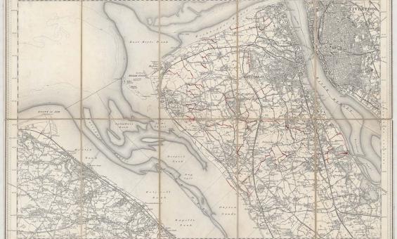
New one inch Ordnance Survey of England & Wales, 1864, nla.gov.au/nla.obj-231933519

This ‘one inch’ topographic map has a scale of one inch on the map representing one mile on the ground (1:63 360). Ordnance Survey maps at this scale provide an overview of an area, including the relationships between cities, villages and other features in the landscape.

British and Irish maps for family historians

Learn how to access historical gazetteers, Ordnance Survey maps, and early atlases to get detailed insights into your family's origins in England, Scotland, Ireland, and Wales.

Research guide
Collection guide
Auchmuty Collection

Delve into Ireland’s rich history and culture with the Auchmuty Collection. Featuring rare books, pamphlets, and journals from 1900 to 1950, this specialised resource explores Anglo-Irish relations, the Irish Free State, and more. A treasure trove for researchers, donated by Margaret Auchmuty in 1983.

Collection guide

Need help?

Our librarians are here to guide you.

Ask a librarian