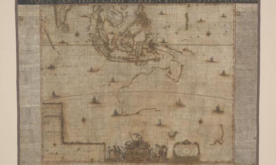
Rare 1602 map of the Sunda Strait
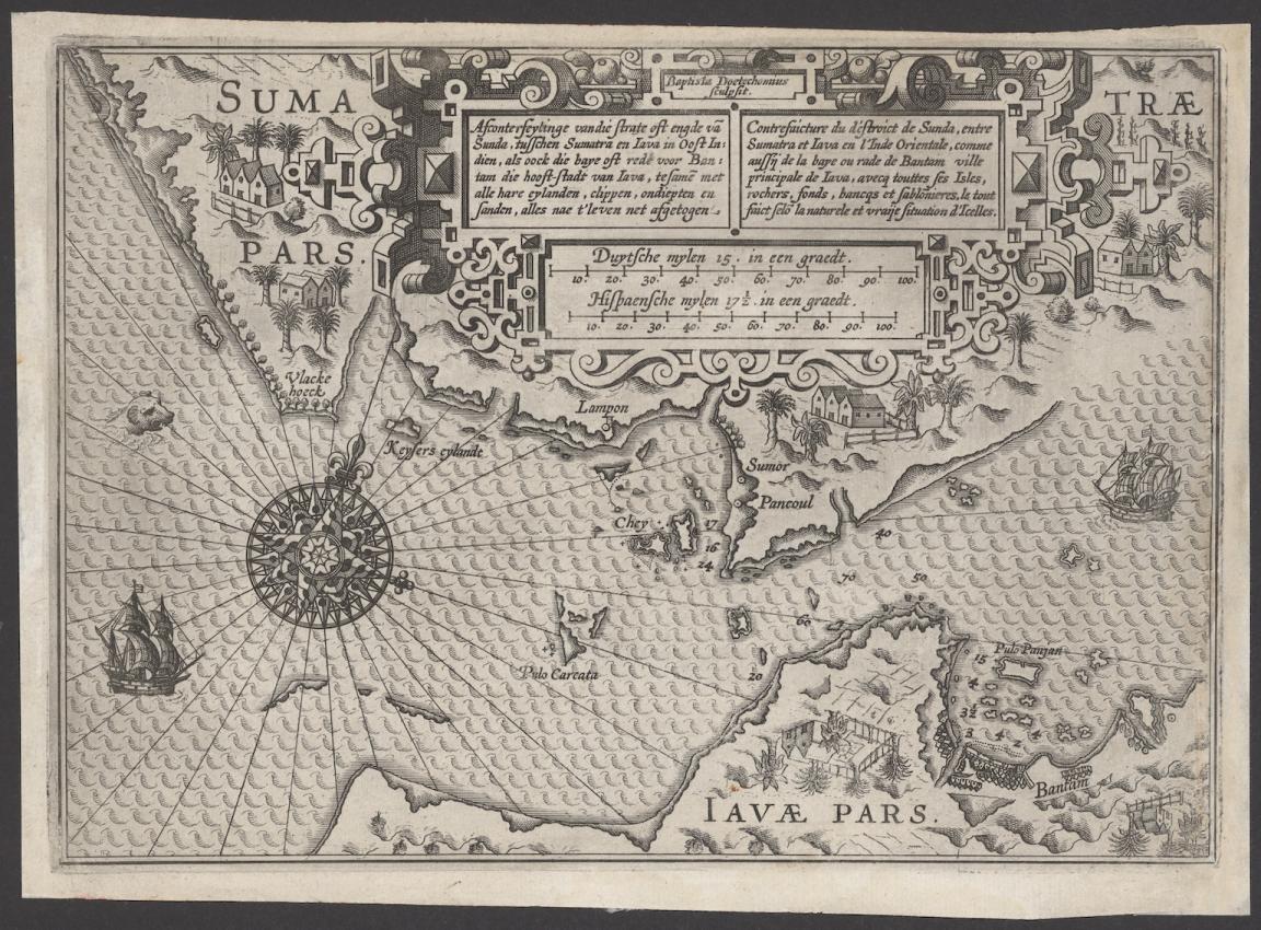
Lucas Janszoon Waghenaer, Afconterfeytinge van die strate oft engde van Sunda, tusschen Sumatra en Iava in Oost Indien, als oock die baye oft rede voor Bantam die hooft-stadt van Iava, tesamen met alle hare eylanden, clippen, ondiepten en sanden, alles nae t' leven net afgetogen, c.1602, nla.gov.au/nla.obj-3444422116
Lucas Janszoon Waghenaer, Afconterfeytinge van die strate oft engde van Sunda, tusschen Sumatra en Iava in Oost Indien, als oock die baye oft rede voor Bantam die hooft-stadt van Iava, tesamen met alle hare eylanden, clippen, ondiepten en sanden, alles nae t' leven net afgetogen, c.1602, nla.gov.au/nla.obj-3444422116
Waghenaer was a notable figure of the Golden Age of Dutch mapmaking, known for his pioneering contributions to nautical cartography. Waghenaer’s charts were not only effective but also fantastically decorated with pictures of navigational symbols, tidal details, landmarks, ships and even a sea monster. Despite some imperfections, the chart was impressively accurate for its day and is engraved with Waghenaer's usual finesse and elegance.
The need for maps and navigational aids during the late 16th and early 17th centuries was significant as the Dutch had become obsessed with Southeast Asian spices in their food, wines and perfumes. Control of the area allowed the Dutch to avoid conflict with the Portuguese, to quickly reach Bantam and the Spice Islands, and was also one of the prime reasons Dutch vessels reached the Australian continent and mapped it.
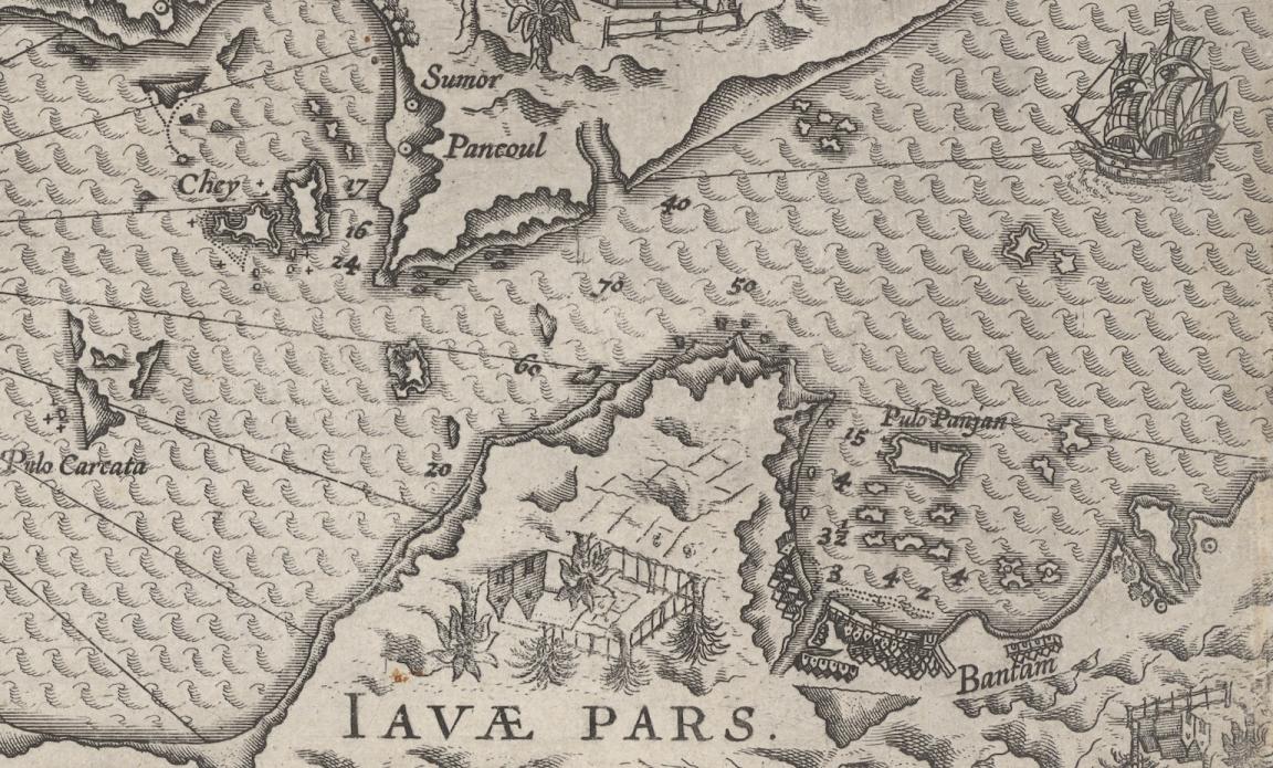
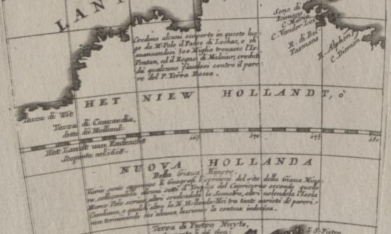
Lucas Janszoon Waghenaer, Afconterfeytinge van die strate oft engde van Sunda, tusschen Sumatra en Iava in Oost Indien, als oock die baye oft rede voor Bantam die hooft-stadt van Iava, tesamen met alle hare eylanden, clippen, ondiepten en sanden, alles nae t' leven net afgetogen (detail), c.1602, nla.gov.au/nla.obj-3444422116
Lucas Janszoon Waghenaer, Afconterfeytinge van die strate oft engde van Sunda, tusschen Sumatra en Iava in Oost Indien, als oock die baye oft rede voor Bantam die hooft-stadt van Iava, tesamen met alle hare eylanden, clippen, ondiepten en sanden, alles nae t' leven net afgetogen (detail), c.1602, nla.gov.au/nla.obj-3444422116
Waghenaer's charts are seen as brilliant productions which presented, for the first time, a detailed chart of a strategic and significant parcel of Indonesian shores. This chart is a great resource for those interested in Dutch cartography and complements later charts in the Library’s collection by providing further context to Dutch expansion and activity in Indonesia.
More to explore

J. van. Loon & Andreas Cellarius, Sitvs terrae circvlis coelestibvs circvndatae, 1660, nla.gov.au/nla.obj-230714394
You might also be interested in
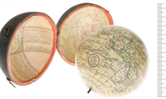
John Cary, William Cary and Jean Baptiste Bourguignon d'Anville, Cary's pocket globe agreeable to the latest discoveries, 1791, nla.gov.au/nla.obj-234207821
Thomas Griffith Taylor and H. O. Beckit, The new Oxford wall maps of Australia, c.1920, nla.gov.au/nla.obj-255201355