Tooley Collection
Collection highlights
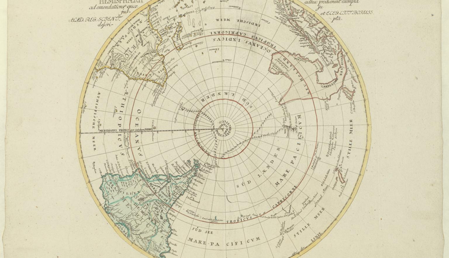
IC Rhode, Tabula geographica hemisphaerii Australis ad emendatiora quae adhuc prodierunt exempla jussu, 1740, nla.gov.au/nla.obj-232531068
IC Rhode, Tabula geographica hemisphaerii Australis ad emendatiora quae adhuc prodierunt exempla jussu, 1740, nla.gov.au/nla.obj-232531068
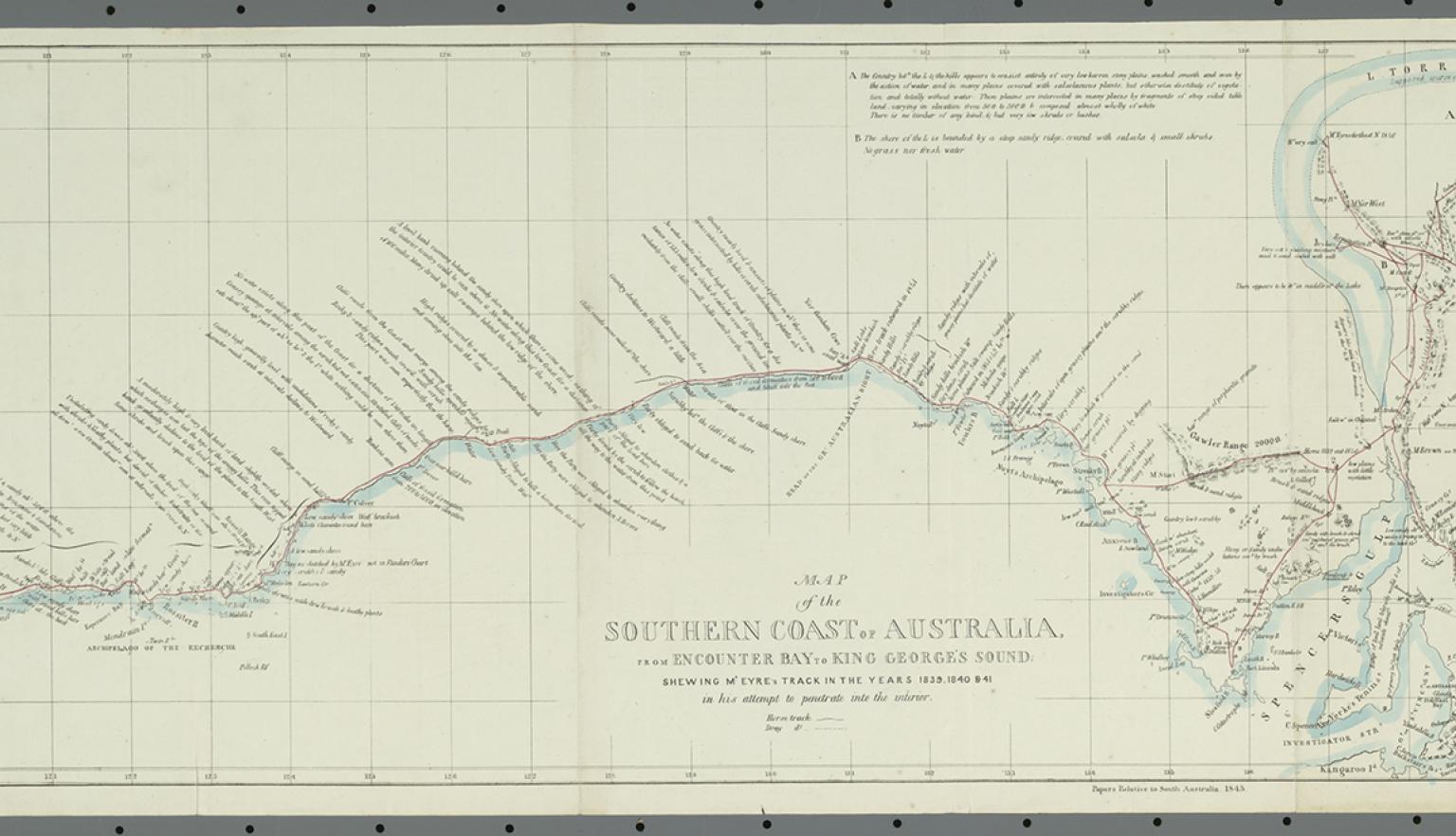
John Arrowsmith and William Clowes and Sons, Map of the southern coast of Australia from Encounter Bay to King George's Sound shewing Mr. Eyre's track in the years 1839, 1830 & 41 in his attempt to penetrate into the interior, 1843, nla.gov.au/nla.obj-232546838
John Arrowsmith and William Clowes and Sons, Map of the southern coast of Australia from Encounter Bay to King George's Sound shewing Mr. Eyre's track in the years 1839, 1830 & 41 in his attempt to penetrate into the interior, 1843, nla.gov.au/nla.obj-232546838
Key items in the collection
Highlights from this collection demonstrate its historical significance and variety.
The strength of the collection is in maritime maps and general maps, including maps of explorers' routes. Many of the maps had been extracted from atlases.
Individual mapmakers represented in the Tooley Collection include:
- Aaron Arrowsmith (1798–1823)
- John Arrowsmith (1832–1862)
- Allard family (1660–1679)
- Adam and Charles Black (1839–1873)
- Blaeu family (1642–1650)
- James Cook (1772–1784)
- Vicenza Coronnelli (1696)
- Alexander Dalrymple (1767–1794)
- William Dawes (1792)
- Hendrick Doncker (1650–1690)
- John Dower (1831–1847)
- Adolphe Dufour (1840–1870)
- Dumont D’Urville (1826–1847)
- J Bruny d’Entrecasteaux (1807)
- GW Evans (1822–1823)
- William Faden (1773–1822)
- Matthew Flinders (1814)
- Louis Freycinet (1801–1808)
- Pieter Goos (1666–1672)
- Thomas Ham (1864–1866)
- Henricus Hondius (1638–1700)
- John Hunter (1789–1792)
- Jan Jansson (1650–1700)
- William Johnston (1844–1890)
- Johannes van Keuelen (1680)
- Phillip Parker King (1824–1833)
- Adam von Krusenstern (1824–1835)
- John Norie (1816–1858)
- George Philip (1852–1877)
- John Sands (1886)
- Edward Stanford (1856–1893)
- Tallis & Co (1851–1854)
- Wyld family (1837–1872).
The collection contains maps produced by the Society for the Diffusion of Useful Knowledge.
The collection also contains a large number of charts issued by the:
- British Admiralty
- French Admiralty.
About Ronald Tooley
Ronald Vere Tooley (1898–1986) was born and educated in London. Tooley served in the Queen's Westminster Rifles in World War I and was one of a minority in his regiment to survive the Battle of Cambrai.
Booksellers and bookshop
In 1919 he joined the London booksellers Francis Edwards Ltd and throughout the 1920s he produced catalogues of rare books and old maps.
Tooley eventually established his own business – the Atlas Bookshop – but it closed in 1936.
After World War II he rejoined Francis Edwards Ltd and, in time, became one of its directors, retiring in 1976.
Tooley's legacy
Tooley devoted a great deal of his time to the history of mapping, carrying out research in the Map Room of the British Museum. His seminal work Maps and Map-makers (912 TOO) was published by Batsford in 1949. A further 5 editions appeared in his lifetime.
In 1963, Tooley and Robert Stockwell founded the Map Collectors' Circle and began the Map Collectors' Series. Tooley was the author of over 30 works in this series, covering maps in:
- Europe
- Africa
- North America
- Australasia.
They included Printed Maps of Australia, which appeared in 7 parts in 1970–73.
In 1979, the following were published:
Background to the collection
Tooley sold his collection of Australian maps to Nico Israel Antiquarian Bookseller of Amsterdam. The Library purchased the collection from Nico Israel in 1973.
The collection is held in the Maps Collection. All the maps are catalogued. The call numbers have the prefix T. The maps have also been digitised. Refer to RV Tooley map collection.
This guide was prepared using these references:
- Tony Campbell and Terry Kay, Obituary of RV Tooley, Imago Mundi, vol 39, 1987, pp 80–1.
- Valerie G Newby, RV Tooley: Twentieth-century map trade pioneer, IMCoS Journal, No 161, June 2020, pp 41–4.
- Helen Wallis and Sarah Tyacke (eds), My Head is a Map: Essays and Memoirs in Honour of RV Tooley, Francis Edwards and Carta Press, London, 1973.
More to explore


Continue your journey
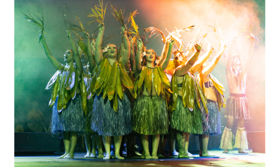
Liza Moscatelli, Cook Island performance in Motu of Western Sydney, 2022, nla.gov.au/nla.obj-3180077661

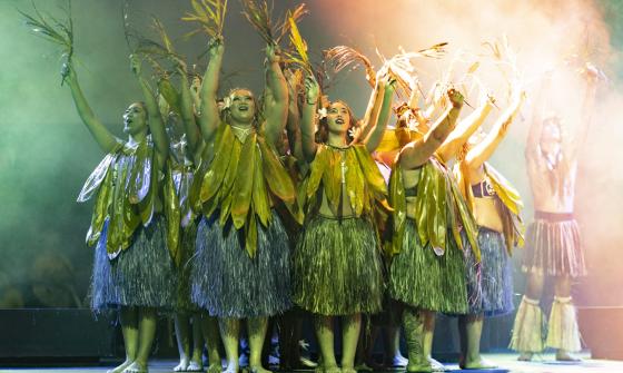
Liza Moscatelli, Matavai Pacific Cultural Arts Dancers performing in 'Motu of Western Sydney', Whitlam Leisure Centre, Liverpool, N.S.W., April, 2022, nla.gov.au/nla.obj-3180077661
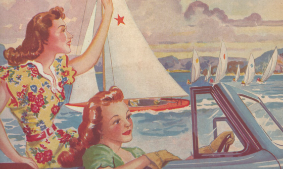
Cover of Air travel and holiday, vol. 1, No. 3 (cropped), March 1948, nla.gov.au/nla.obj-3997211269