Europe

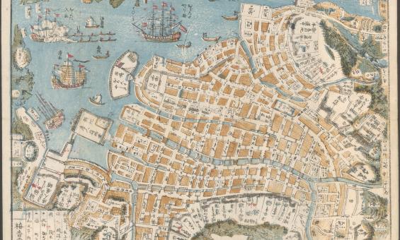
Shinsen Nagasaki no zu, 1801, nla.gov.au/nla.obj-230571001

PIC MSR 14/8/2 #PIC/14340/1-51-Early Flemish, German, Italian, Spanish, French woodcuts, nla.gov.au/nla.obj-2902124119
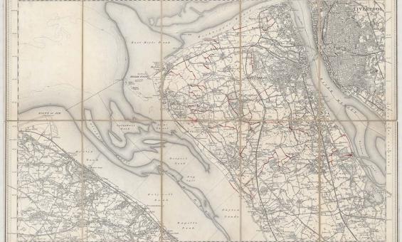
New one inch Ordnance Survey of England & Wales, 1864, nla.gov.au/nla.obj-231933519
This ‘one inch’ topographic map has a scale of one inch on the map representing one mile on the ground (1:63 360). Ordnance Survey maps at this scale provide an overview of an area, including the relationships between cities, villages and other features in the landscape.