Early settlement
The first published map of Port Jackson
This map is attributed to Francis Fowkes, an active artist in the new settlement at Sydney Cove from 1788 to 1800. Fowkes, a former midshipman, was sentenced to transportation for stealing a coat and boots.
This is a copy of the drawing that, when it was returned to Britain with the First Fleet ships in 1789, became the first published map of Port Jackson. Fowkes optimistically depicts a governor’s mansion and flourishing farm, yet no such building existed at the time and starvation threatened the fledgling colony.
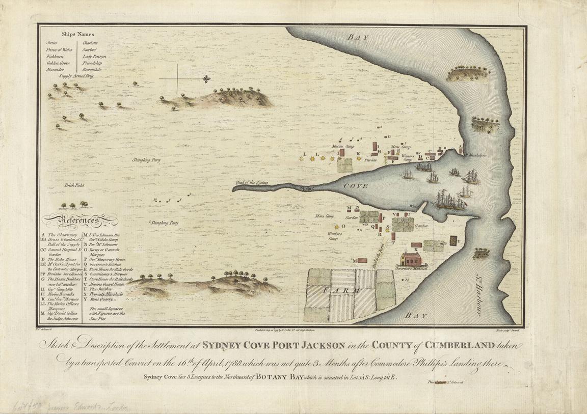
Francis Fowkes, R Cribb Neele & John Samuel, Sketch & description of the settlement at Sydney Cove Port Jackson in the County of Cumberland taken by a transported convict on the 16th of April, 1788, which was not quite 3 months after Commodore Phillips's landing there, 1789, nla.gov.au/nla.obj-230578175
Francis Fowkes, R Cribb Neele & John Samuel, Sketch & description of the settlement at Sydney Cove Port Jackson in the County of Cumberland taken by a transported convict on the 16th of April, 1788, which was not quite 3 months after Commodore Phillips's landing there, 1789, nla.gov.au/nla.obj-230578175
Activity 1: Analysing the map
Step 1: Map analysis
Share this map with your students and encourage them to study it carefully. Pay special attention to the title and reference sections. Help students understand unfamiliar terms used in the map, such as “marquee,” “smithy,” and “observatory,” by explaining their meanings in context.
Step 2: Brainstorming tasks in the new settlement
Using the map, brainstorm tasks that were crucial to establishing the settlement at Sydney Cove after the arrival of the First Fleet. For example:
- What would people need to do to build homes and workplaces?
- How would they grow food or find water?
- What roles would people like blacksmiths, doctors, or convicts play in the survival of the colony?
Step 3: Role-playing life in the new colony
Ask your students to imagine they are one of the people living in Sydney Cove during the first months of the settlement. They could be a commander, blacksmith, doctor, or convict. Using the map as a guide, students should write a diary entry about their day. Encourage them to think about:
- Where they went in the settlement
- How they got there
- What tasks they performed
- Who they interacted with
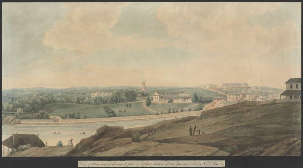
Richard Read, View of Government domain & part of Sydney taken from Bunkers Hill, N.S. Wales,1820, nla.gov.au/nla.obj-135199740
Richard Read, View of Government domain & part of Sydney taken from Bunkers Hill, N.S. Wales,1820, nla.gov.au/nla.obj-135199740
Activity 2: Comparing early and later views of Sydney Cove
Step 1: Examining the changes
Show your students a painting by Richard Read (c. 1765–c. 1827), created in about 1820. This artwork gives a later perspective of Sydney Cove, over 30 years after the First Fleet arrived.
Step 2: Class discussion
Invite your students to compare Fowkes’ 1788 sketch with Read’s 1820 painting. As a class, discuss the changes that occurred in Sydney Cove over those early decades of European settlement. Consider:
- What new buildings and structures appeared?
- How did the settlement grow and develop?
- What might life have been like in 1788 compared to 1820?
More to explore