Maps | National Library of Australia (NLA)

Maps

Showing 13 - 24 of 47 results
This squatting map of Victoria shows counties, road and rail lines, settlements and subdivisions. Relief is shown on the map using hachures.

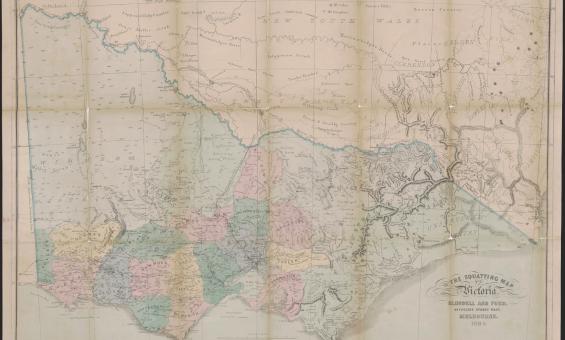
Thomas Ham, Blundell and Ford, The squatting map of Victoria, 1864-1865, nla.gov.au/nla.obj-231392173

This squatting map of Victoria shows counties, road and rail lines, settlements and subdivisions. Relief is shown on the map using hachures.

Pastoral or squatting maps

Early pastoral or squatting maps can help you locate pastoral properties relating to ownership before Torrens Title, and for identifying large pastoral and squatting runs. Many maps we have can be viewed online, and all can be viewed at the Library.

Research guide
1912 map of the Parish of Booroomba, County of Cowley Land District of Queanbyan, Yarrowlumla Shire, Commonweath territory

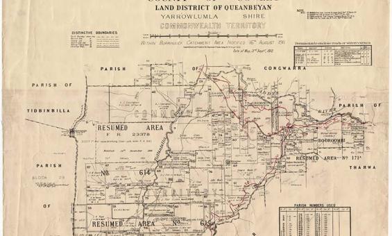
New South Wales, Department of Lands, Parish of Booroomba, County of Cowley Land District of Queanbeyan, Yarrowlumla Shire, Commonwealth Territory, 1912, nla.gov.au/nla.obj-233985512

Parish, town and county maps

Published by the State Lands Departments from the 1860s onwards parish, town and county maps can be used to find land holdings, show boundaries, land use and types of ownership.

Research guide
A group of men performing a traditional dance

Terence & Margaret Spencer, Independence Day Celebration (15) Port Moresby, Papua New Guinea, 1975, nla.gov.au/nla.obj-145645567

Pacific collections

The National Library holds a rich and diverse range of library materials on the Pacific region, New Zealand and Papua New Guinea.

Information article
map of New Caledonia, 1942

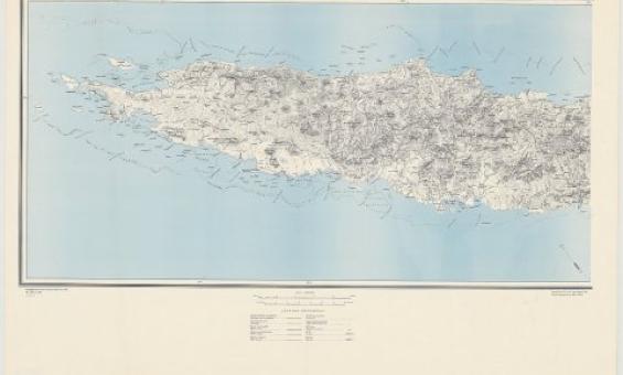
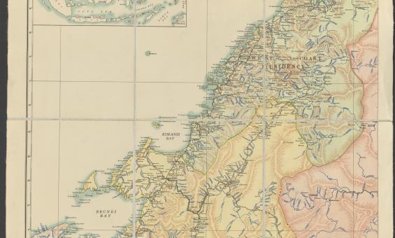
Great Britain. War Office. (1942). New Caledonia, nla.gov.au/nla.obj-233403296

Overseas series mapping research guide

Learn about the types of maps we hold and how to access them, including maps for countries, oceans and the planets.

Research guide
1864 map of England and Wales

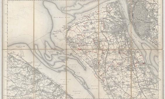
New one inch Ordnance Survey of England & Wales, 1864, nla.gov.au/nla.obj-231933519

This ‘one inch’ topographic map has a scale of one inch on the map representing one mile on the ground (1:63 360). Ordnance Survey maps at this scale provide an overview of an area, including the relationships between cities, villages and other features in the landscape.

Ordnance Survey maps

Ordnance Survey maps can give you detailed geographic information for England, Wales, Scotland and Ireland from the early 1800s onwards.

Research guide
A detailed historical map of Sydney Cove, Port Jackson, depicting early settlement areas, marked camps, and referenced landmarks such as gardens and marine camps. Includes a list of ship names from the First Fleet and geographical details.

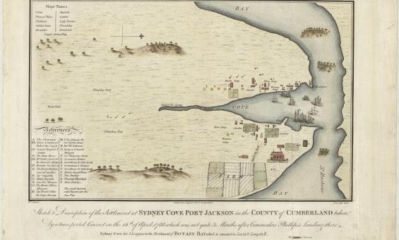
Francis Fowkes, Sydney Cove, Port Jackson, in the County of Cumberland, 1789, nla.gov.au/nla.obj-230578175 

Nan Kivell Collection

About 5,000 books, pamphlets and periodicals, over 11,000 paintings, drawings and prints, around 800 maps and over 300 manuscripts mostly published 1770–1900. Largely relating to Australia, New Zealand and the Pacific including Antarctica.

Collection guide
First Australians
Collection guide
Maple-Brown Collection

614 books and pamphlets, mostly published overseas in the period 1850–1950, including children’s books, novels, atlases, scripture readings, prayer books, hymn books, works on theology, school textbooks and some historical works.

Collection guide
Screenshot showing part of the Port of Sydney in 1919
Map Search: Historical maps overlaid on modern maps

View historical maps overlaid on a modern map.

Information article
Hand-drawn historical map of a coastal city with detailed streets, waterways, and buildings. Various ships are shown in the harbor, including sailing ships with multiple masts. The map contains handwritten labels in an East Asian script, with buildings and city layout depicted in a bird's-eye view.

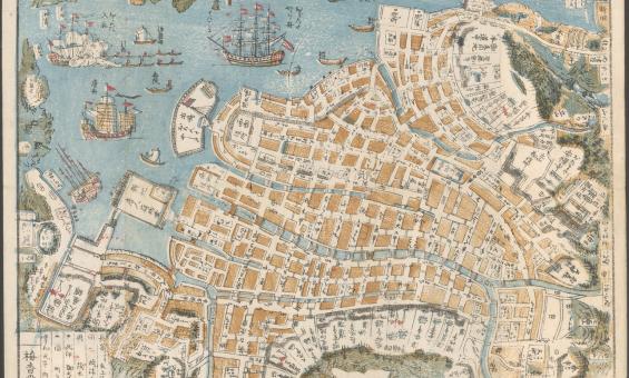
Shinsen Nagasaki no zu, 1801, nla.gov.au/nla.obj-230571001

London Missionary Society Collection

722 books, pamphlets, leaflets, manuscripts, newspapers and maps, mostly written in Chinese. Mainly Christian works, plus works on the Chinese language, reprints of classical writings and works relating to the Taiping Rebellion of 1850-64.

Collection guide
a coloured map of British North Borneo

http://nla.gov.au/nla.obj-742754582

Loke Wan Tho Collection

A large number of photographs and negatives taken by Loke Wan Tho on his ornithological expeditions to the Pacific, Asia and Europe in the 1950s and early 1960s, as well as papers, books and maps.

Collection guide
Collection guide
Johnston Collection

Over 13,000 negatives, transparencies, and photographs of cattle stations taken between 1951 and 1961, as well as 52 British Hydrographic Office charts and maps of Australia and the Pacific and personal papers of Johnston.

Collection guide
An antique world map titled 'General Chart' showing the discoveries made by Captain James Cook during his voyages.

Lieut Henry Roberts, A general chart exhibiting the discoveries made by Capt. James Cook in this and his two preceding voyages, 1789, nla.gov.au/nla.obj-230604992

James Cook and his voyages

Our James Cook collection showcases the Library’s most famous item - Cook’s HMS Endeavour journal.

Collection guide

Need help?

Our librarians are here to guide you.

Ask a librarian