Family history and genealogy | National Library of Australia (NLA)

Family history and genealogy

Showing 1 - 12 of 39 results
A black-and-white photo of a family posed outside a brick house with a white picket fence. In the foreground, a man in a bowler hat sits beside a large dog, while a young girl stands nearby. A seated woman holds a baby on her lap, and a child is visible on the steps of the house in the background. The garden surrounding them is filled with overgrown plants.

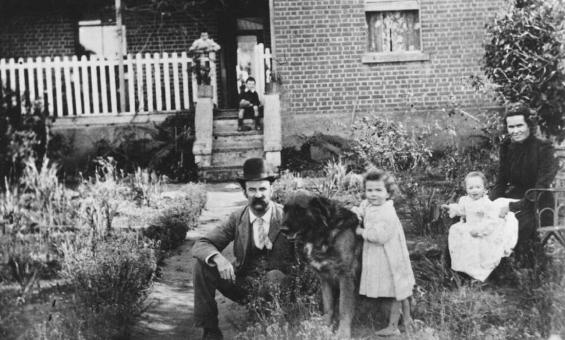
Portrait of Oliver Barberie and family, 1900, nla.gov.au/nla.obj-136621963

Family history research guide

Uncover hidden stories of your heritage and trace your genealogy using our research guide.

Research guide
Collection guide
Valente Collection

Around 6,000 books, mostly in Portuguese, mostly relating to literature, history and religion among many other topics.

Collection guide
Members of a family standing in a line from oldest to youngest

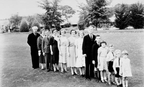
A. Collingridge, Portrait of the Lyons family, Canberra, ca. 1935 nla.obj-137397778

Tracing your family history with the Library’s charts and forms

Learn about the Library's family history research charts and how to find the information to fill them in.

Blog
Black and white photo of a small child playing with a wooden box and a hammer

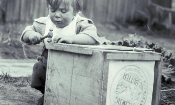
C. R. Gotts, Philip Gotts, playing with a wooden box, 1921, nla.gov.au/nla.obj-144214274

Thinking outside the box: Creative approaches to family history research

See our outside-the-box strategies to help you uncover the hidden branches of your family tree.

Blog
Woman with curly hair standing in front of a wall of framed family photos in the Hopes and Fears exhibition
The family mantlepiece

Learn about the mantlepiece display at the entrance to our Hopes and Fears: Australian Migration Stories exhibition.

Blog
Two men, one on a ladder, looking at books on large bookshelf at the State Library of Victoria

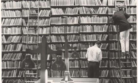
Mark Strizic, Searching for books at the State Library of Victoria, January 1967, nla.gov.au/nla.obj-140508667
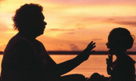
The art of literary investigation

Learn how to uncover facts and colour from historical documents, manuscripts, newspapers and more.

Learning activity for adults
Video
A sepia-toned photograph showing a group of passengers relaxing on the deck of a ship. Men and women are seated on deck chairs, dressed in late 19th or early 20th-century clothing, with hats and striped dresses visible. The background shows ship rigging and sails.

Ship passengers relaxing on deck, 1870, nla.gov.au/nla.obj-146719701

Shipping and passenger records

Find immigration records, shipping and passenger lists for fare-paying passengers, assisted migrants and crew members to reveal key details about your family members arrival in Australia.

Research guide
A historic real estate map advertising a land auction at Circular Quay and George Street, Sydney, dated May 30th, 1900. The layout showcases plots available for development, labeled "colored red," situated near the wharves, shops, and notable buildings. Text emphasizes the commercial opportunities of the site, positioned near tram and maritime terminals.

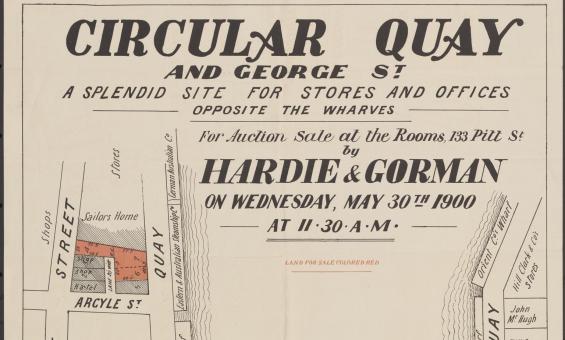
Hardie & Gorman Pty. Ltd & W. E. Smith Ltd, Circular Quay and George St., a splendid site for stores and offices, opposite the wharves for auction sale at the rooms, 133 Pitt St,  nla.gov.au/nla.obj-230508873

Real estate or sales plans

Use sales plans to find information about land sales, such as prices, boundaries, roads and land use.

Research guide
This squatting map of Victoria shows counties, road and rail lines, settlements and subdivisions. Relief is shown on the map using hachures.

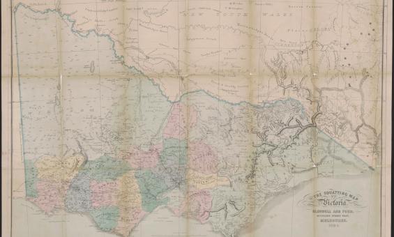
Thomas Ham, Blundell and Ford, The squatting map of Victoria, 1864-1865, nla.gov.au/nla.obj-231392173

This squatting map of Victoria shows counties, road and rail lines, settlements and subdivisions. Relief is shown on the map using hachures.

Pastoral or squatting maps

Early pastoral or squatting maps can help you locate pastoral properties relating to ownership before Torrens Title, and for identifying large pastoral and squatting runs. Many maps we have can be viewed online, and all can be viewed at the Library.

Research guide
1912 map of the Parish of Booroomba, County of Cowley Land District of Queanbyan, Yarrowlumla Shire, Commonweath territory

New South Wales, Department of Lands, Parish of Booroomba, County of Cowley Land District of Queanbeyan, Yarrowlumla Shire, Commonwealth Territory, 1912, nla.gov.au/nla.obj-233985512

Parish, town and county maps

Published by the State Lands Departments from the 1860s onwards parish, town and county maps can be used to find land holdings, show boundaries, land use and types of ownership.

Research guide
1864 map of England and Wales

New one inch Ordnance Survey of England & Wales, 1864, nla.gov.au/nla.obj-231933519

This ‘one inch’ topographic map has a scale of one inch on the map representing one mile on the ground (1:63 360). Ordnance Survey maps at this scale provide an overview of an area, including the relationships between cities, villages and other features in the landscape.

Ordnance Survey maps

Ordnance Survey maps can give you detailed geographic information for England, Wales, Scotland and Ireland from the early 1800s onwards.

Research guide
A newspaper stand with headlines about an attempt to kill the King

Newspaper stand in a railway station headlining attempt to kill King, Victoria, 1936, nla.gov.au/nla.obj-152826154

Newspapers for family history

Learn some useful tips and suggestions on how to use newspapers for family history research.

Learning activity for adults
Video

Need help?

Our librarians are here to guide you.

Ask a librarian