Family history and genealogy | National Library of Australia (NLA)

Family history and genealogy

Showing 25 - 36 of 45 results
5 First Nations Family History Books on a light shelf on display

Some of the First Nations family history reference books that can be found in our collection.

Getting started with First Nations family history

Find useful tips and things to keep in mind here as you start your family history journey.  

Research guide
Excerpt from John Bartholomew and Son, Gazetteer of the British Isles, 9th ed., 1970, showing alphabetical listing of place names with details of each.

John Bartholomew and Son, Gazetteer of the British Isles, 1970, nla.gov.au/catalog/1374709

Historical gazetteers

Gazetteers are listings of places and can provide useful details, such as territorial division, location, alternate names, population size, and more.

Research guide
Collection guide
Hood Collection

About 240 recordings of folk music, folklore, and oral histories documenting family history, local history, work experiences, music and other arts.

Collection guide
A sample of an emigration pass. It says 'Colonial Emigration Form, Man's Emigration Pass' with signatures and handwritten information.
Indian emigration passes to Fiji 1879 - 1916

Find out how to access over 60,000 passes issued to Indian people who came to Fiji as indentured labourers.

Research guide
A black and white photograph of a family dressed in late 1800s style fashion. The are standing in a clearing in a forest and are standing in front of a tent.

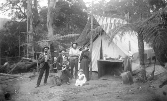
William Henry Corkhill, Jim Stephens, Steven Marsden, Charlie Marsden, his wife Rebecca and their children Millie and Stephen outside their tent, Mt Dromedary, ca.1899, nla.gov.au/nla.obj-140334789

Learning webinar: Family history for beginners

Delve into our collections with our Research Librarians and uncover your family history.

Event
Learning activity for adults
Video
Map of eastern Australia noting where there are organised churches, mission centres and outstations

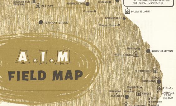
Aborigines Inland Mission of Australia, A.I.M. field map, 1972, nla.gov.au/nla.obj-2848085500

Missions and reserves records

Searching the administrative records of the missions and reserves can help you fill important gaps in your family history. 

Research guide
National Library Special Collections Research and support Team
Most common family history questions we get asked at the Library: Part 1

In the first of two blogs, learn about birth certificates, First Nations family history, electoral rolls, and cemetery records.

Blog
Family history desk common questions blog
Most common family history questions we get asked at the Library: Part 2

In our second blog, find out how to find information on births, deaths, addresses and property records.

Blog
A newspaper stand with headlines about an attempt to kill the King

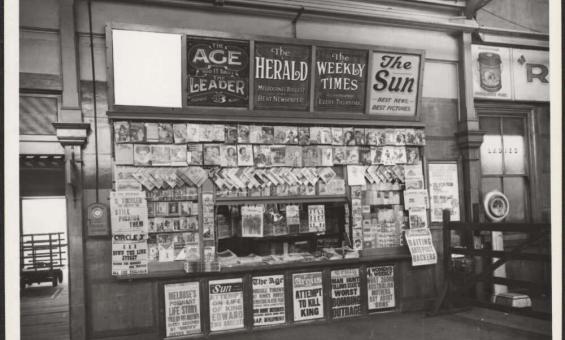
Newspaper stand in a railway station headlining attempt to kill King, Victoria, 1936, nla.gov.au/nla.obj-152826154

Newspapers for family history

Learn some useful tips and suggestions on how to use newspapers for family history research.

Learning activity for adults
Video
1864 map of England and Wales

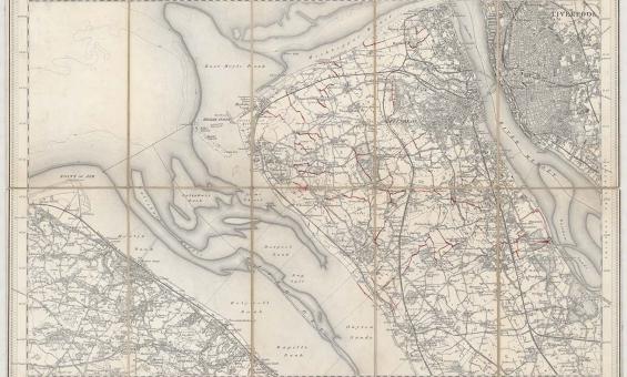
New one inch Ordnance Survey of England & Wales, 1864, nla.gov.au/nla.obj-231933519

This ‘one inch’ topographic map has a scale of one inch on the map representing one mile on the ground (1:63 360). Ordnance Survey maps at this scale provide an overview of an area, including the relationships between cities, villages and other features in the landscape.

Ordnance Survey maps

Ordnance Survey maps can give you detailed geographic information for England, Wales, Scotland and Ireland from the early 1800s onwards.

Research guide
1912 map of the Parish of Booroomba, County of Cowley Land District of Queanbyan, Yarrowlumla Shire, Commonweath territory

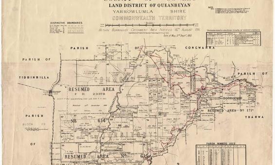
New South Wales, Department of Lands, Parish of Booroomba, County of Cowley Land District of Queanbeyan, Yarrowlumla Shire, Commonwealth Territory, 1912, nla.gov.au/nla.obj-233985512

Parish, town and county maps

Published by the State Lands Departments from the 1860s onwards parish, town and county maps can be used to find land holdings, show boundaries, land use and types of ownership.

Research guide
This squatting map of Victoria shows counties, road and rail lines, settlements and subdivisions. Relief is shown on the map using hachures.

Thomas Ham, Blundell and Ford, The squatting map of Victoria, 1864-1865, nla.gov.au/nla.obj-231392173

This squatting map of Victoria shows counties, road and rail lines, settlements and subdivisions. Relief is shown on the map using hachures.

Pastoral or squatting maps

Early pastoral or squatting maps can help you locate pastoral properties relating to ownership before Torrens Title, and for identifying large pastoral and squatting runs. Many maps we have can be viewed online, and all can be viewed at the Library.

Research guide

Need help?

Our librarians are here to guide you.

Ask a librarian