Western Australia | National Library of Australia (NLA)

Western Australia

Showing 1 - 10 of 10 results
A historic real estate map advertising a land auction at Circular Quay and George Street, Sydney, dated May 30th, 1900. The layout showcases plots available for development, labeled "colored red," situated near the wharves, shops, and notable buildings. Text emphasizes the commercial opportunities of the site, positioned near tram and maritime terminals.

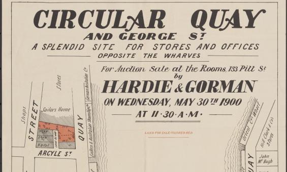
Hardie & Gorman Pty. Ltd & W. E. Smith Ltd, Circular Quay and George St., a splendid site for stores and offices, opposite the wharves for auction sale at the rooms, 133 Pitt St,  nla.gov.au/nla.obj-230508873

Real estate or sales plans

Use sales plans to find information about land sales, such as prices, boundaries, roads and land use.

Research guide
Collection guide
Plane Table Surveys Collection

182 original field sheets, representing 32 map sheets, dating from 1915 to 1936 including surveys carried out in Queensland, New South Wales, Victoria and Western Australia.

Collection guide
This squatting map of Victoria shows counties, road and rail lines, settlements and subdivisions. Relief is shown on the map using hachures.

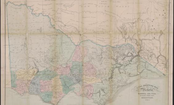
Thomas Ham, Blundell and Ford, The squatting map of Victoria, 1864-1865, nla.gov.au/nla.obj-231392173

This squatting map of Victoria shows counties, road and rail lines, settlements and subdivisions. Relief is shown on the map using hachures.

Pastoral or squatting maps

Early pastoral or squatting maps can help you locate pastoral properties relating to ownership before Torrens Title, and for identifying large pastoral and squatting runs. Many maps we have can be viewed online, and all can be viewed at the Library.

Research guide
1912 map of the Parish of Booroomba, County of Cowley Land District of Queanbyan, Yarrowlumla Shire, Commonweath territory

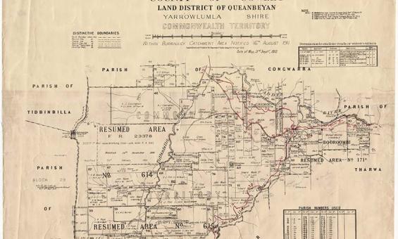
New South Wales, Department of Lands, Parish of Booroomba, County of Cowley Land District of Queanbeyan, Yarrowlumla Shire, Commonwealth Territory, 1912, nla.gov.au/nla.obj-233985512

Parish, town and county maps

Published by the State Lands Departments from the 1860s onwards parish, town and county maps can be used to find land holdings, show boundaries, land use and types of ownership.

Research guide
black and white photo of old buildings with old cars in the street out the front

Fairfax Corporation, New South Wales State Parliament House with automobiles parked outside, Sydney, ca. 1930, nla.gov.au/nla.obj-162790401

Other states and territories legislation

The printed collections at the National Library contain substantial collections of older legislation in print, though these may not be complete sets. 

Research guide
Collection guide
Mitchell Collection

Oral history interviews with prominent Australian women.

Collection guide
Collection guide
Johnston Collection

Over 13,000 negatives, transparencies, and photographs of cattle stations taken between 1951 and 1961, as well as 52 British Hydrographic Office charts and maps of Australia and the Pacific and personal papers of Johnston.

Collection guide
A bold poster with stacked red text in different fonts reads: COMMONWEALTH OF AUSTRALIA, REFERENDUM, 1916 (MILITARY SERVICE), POLLING: SATURDAY, 28th October, 1916, Commonwealth Electoral Rolls close Monday, 18th Sept., 1916  ARE YOU CORRECTLY ENROLLED for the Electoral Subdivision for which you are entitled to be enrolled? Qualified persons who fail to enrol are liable to a PENALTY OF TWO POUNDS. J. G. McLAREN, Commonwealth Electoral Officer for the State of New South Wales. Sydney, 5th September, 1916.

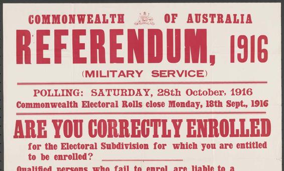
McLaren, J. G and Commonwealth Electoral Office (Australia) issuing body, Referendum, 1916 (military service) : are you correctly enrolled for the electoral subdivision for which you are entitled to be enrolled? Sydney, 1916, nla.gov.au/nla.obj-348412875

Electoral rolls research guide

Find out how to use electoral rolls to locate your family members or other peoples location or addresses over the years and who was living with them.

Research guide
A black-and-white photograph showing a large wedding party posed on the steps of a wooden house. The group includes men, women, and children dressed in formal Victorian attire. The women are in elaborate dresses, some holding small bouquets. The men wear suits, some with top hats, and a small boy peeks around a door frame to the left.

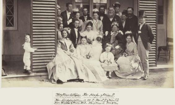
Album of photographs of Bushy Park, Tasmania, and Dandenong, Victoria, 1875, nla.gov.au/nla.obj-139460187

Births, deaths and marriages

Find out how to access and use BDM records to link generations and branches of your family.

Research guide
1892 map of the Parish of Tullamarine and Parish of Maribrynong

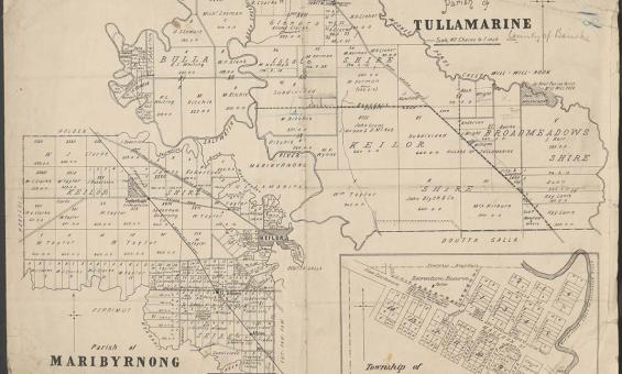
Parish of Tullamarine Parish of Maribyrnong, 1892, nla.gov.au/nla.obj-232027555

Australian maps for family historians

Discover land and property history with our extensive map collection and enrich your family history research with unique geographical records.

Research guide

Need help?

Our librarians are here to guide you.

Ask a librarian