Maps | National Library of Australia (NLA)

Maps

Showing 1 - 12 of 40 results
Globe of the world, surrounded with rings depicting the 'horizon' and signs of zodiac

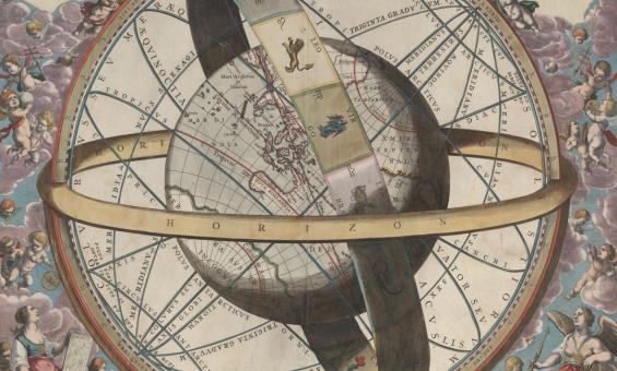
J. van. Loon & Andreas Cellarius, Sitvs terrae circvlis coelestibvs circvndatae, 1660, nla.gov.au/nla.obj-230714394

Maps

Our Maps collection includes around 1 million maps, from early European charts to current mapping of Australia, in print and digital form.

Information article
Tokyo and environs road map

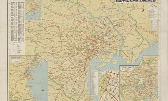
Tokyo and environs road map, 1953, nla.gov.au/nla.obj-1584417804

Williams Collection

About 3200 books, pamphlets, serials, maps, newspapers and ephemera mainly related to Japan plus some works on China and Korea.

Collection guide
Hand drawn map with latin title Mar di India, there are various little cherubs around the title.

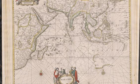
Jan Jansson & Hendrick Doncker, Mar di India, 1659, nla.gov.au/nla.obj-230757141

Using the Maps collection

How to find and use items in the Maps Collection.

Information article
Library services
A black and white map showing Australia, then called New Holland, in the late 1600s.
Two recently acquired Coronelli globe gores

The Library has recently acquired two 17th century globe gores by Vincenzo Coronelli.

News article
Detailed map of the southern cost of Australia with various annotations and notes

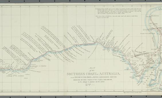
John Arrowsmith and William Clowes and Sons, Map of the southern coast of Australia from Encounter Bay to King George's Sound shewing Mr. Eyre's track in the years 1839, 1830 & 41 in his attempt to penetrate into the interior, 1843, nla.gov.au/nla.obj-232546838

Tooley Collection

1,277 charts and maps dating from the 16th to the late 19th centuries, including maps of the Pacific and New Zealand as well as Australia.

Collection guide
Collection guide
Sakakibara Collection

About 2600 books, mostly in Japanese including military works, biographies of the Japanese Royal Family and leading figures in Japan and Western countries, Chinese and Japanese classics and more.

Collection guide
Collection guide
Royal Society of Edinburgh Admiralty Charts Collection

99 first-issue charts and views of Australian coasts published by the Admiralty between 1814 and 1861.

Collection guide
A 1920s map of Australia showing distribution of cattle and minerals

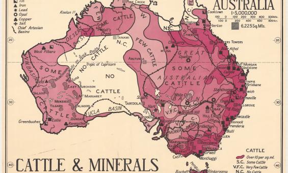
Thomas Griffith Taylor and H. O. Beckit, The new Oxford wall maps of Australia, c.1920, nla.gov.au/nla.obj-255201355
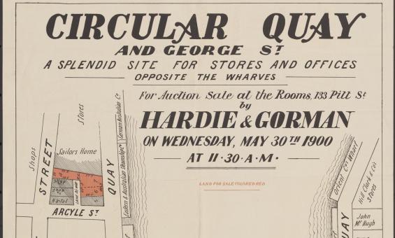
Rights and the Maps Collection

A summary of copyright and rights in the Maps Collection.

Information article
An old black and white map of the Sunda Strait decorated with pictures of navigational symbols, landmarks and ships

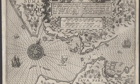
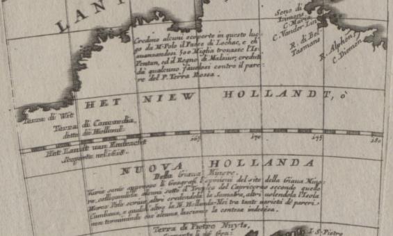
Lucas Janszoon Waghenaer, Afconterfeytinge van die strate oft engde van Sunda, tusschen Sumatra en Iava in Oost Indien, als oock die baye oft rede voor Bantam die hooft-stadt van Iava, tesamen met alle hare eylanden, clippen, ondiepten en sanden, alles nae t' leven net afgetogen, c.1602, nla.gov.au/nla.obj-3444422116

Rare 1602 map of the Sunda Strait

A very rare chart of the Sunda Strait – located between the Indonesian islands of Sumatra and Java – from 1602 has recently been added to our collection.

News article
Collection guide
Plane Table Surveys Collection

182 original field sheets, representing 32 map sheets, dating from 1915 to 1936 including surveys carried out in Queensland, New South Wales, Victoria and Western Australia.

Collection guide
Collection guide
Petherick Collection

About 15,000 books and pamphlets. The great strength of the collection is in Pacific voyages and early Australiana with many very rare items. Also manuscripts including papers of Joseph Banks, maps and pictures.

Collection guide
First Australians
A group of men performing a traditional dance

Terence & Margaret Spencer, Independence Day Celebration (15) Port Moresby, Papua New Guinea, 1975, nla.gov.au/nla.obj-145645567

Pacific collections

The National Library holds a rich and diverse range of library materials on the Pacific region, New Zealand and Papua New Guinea.

Information article

Need help?

Our librarians are here to guide you.

Ask a librarian