Maps
About the Maps collection
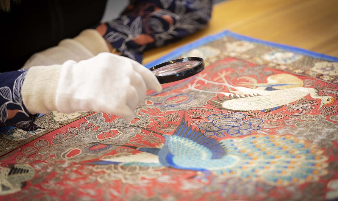
Maps are records that help people navigate, find places or show where landmarks or specific sites are. They can also show plans of where things might be developed or built. They also reveal historical perspectives, showing what people valued and how they imagined the world.
In the collection
- Rare maps – Printed and manuscript maps from the late 15th century to today, featuring significant works from around the world.
- Topographic maps – 200,000 maps (post-1900) from national and state mapping authorities.
- Property and subdivision maps – Covering all Australian states and territories, ideal for family history research.
- Thematic maps – Featuring land use, water and resource management, geology, mining, transport, roads, planning, infrastructure, and military mapping.
- Aerial photographs – 800,000 images of Australia, Papua New Guinea, and Antarctica.
- Rare atlases – Landmark atlases created by some of the most influential names in cartography.
- Overseas maps – Maps of regions near and far from Australia, including Asia, the Pacific, Europe, Africa, and the Americas.
- Globes – A unique collection of over 40 globes, including miniature, pocket, table, and large display globes.
- Formed collections – Major map collections held by the Library, showcasing historical and thematic strengths.
- Reference materials – Street directories, atlases, gazetteers, and more.
Using the Maps collection
Each collection format has its own methods for accessing and using its items.
Please refer to the specific guidelines on Using the Maps collection.
Highlighted items
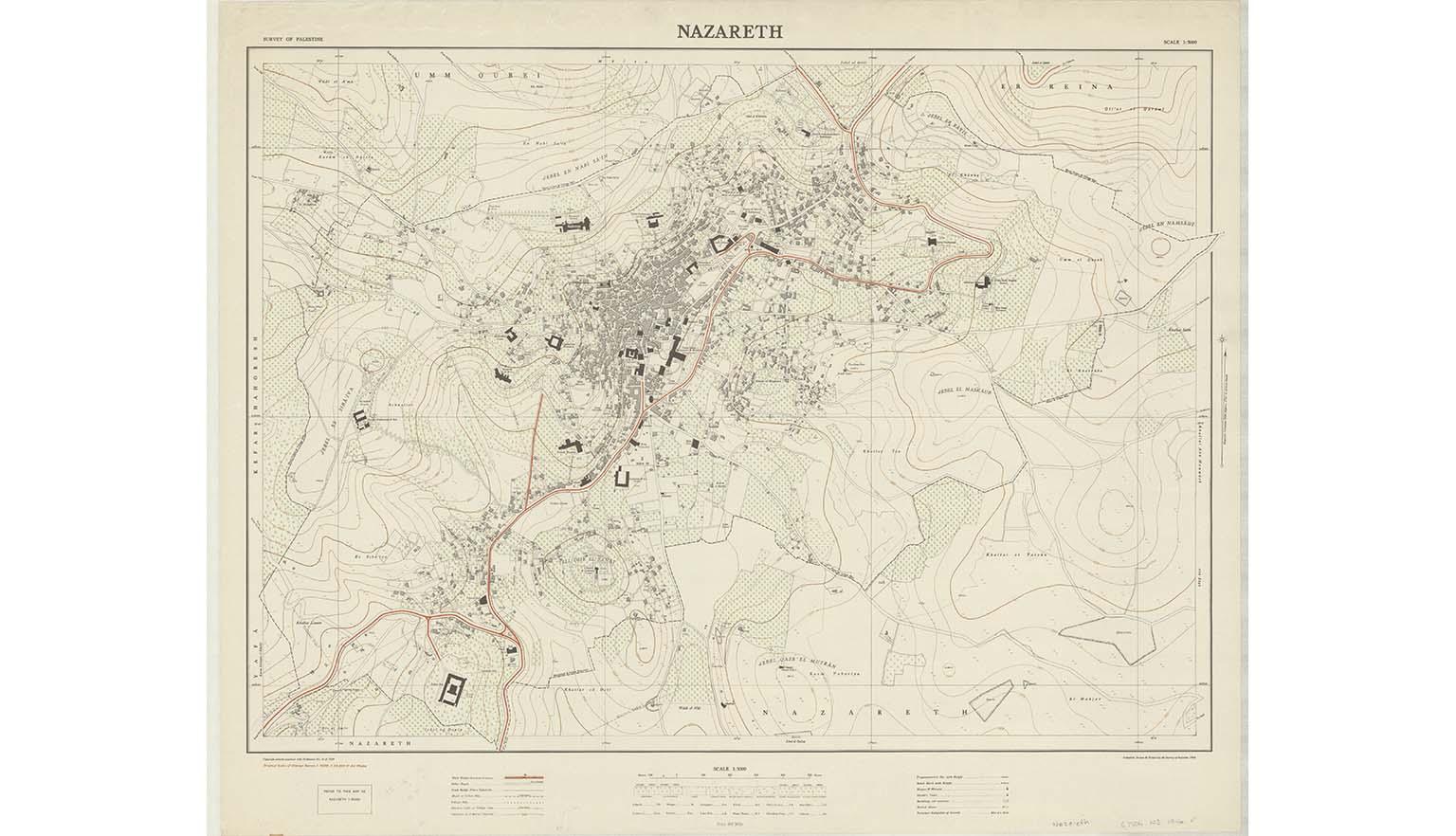
Survey of Palestine, (1946), Nazareth, nla.gov.au/nla.obj-233014254
Survey of Palestine, (1946), Nazareth, nla.gov.au/nla.obj-233014254
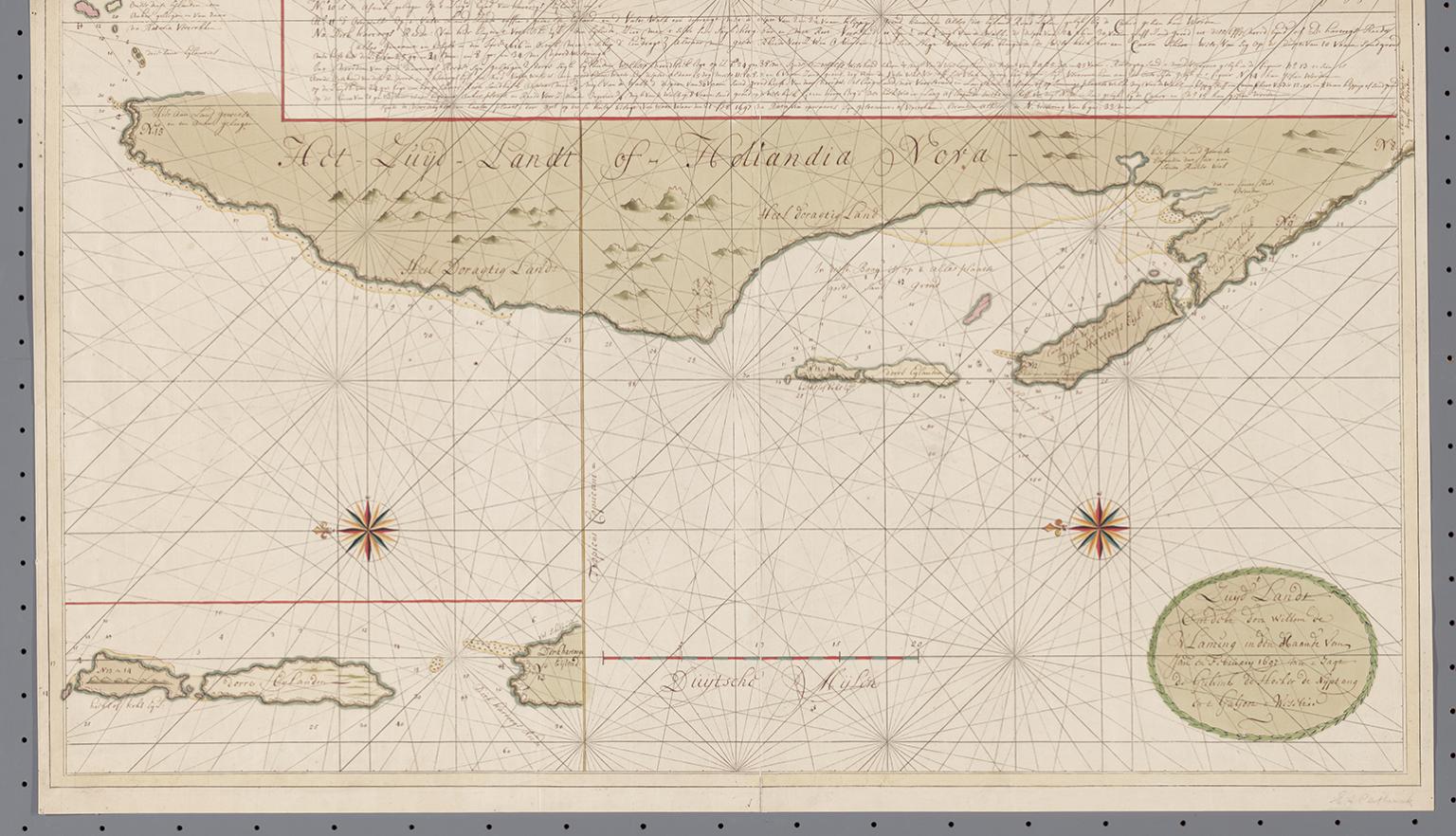
Gerard van Keulen & Günter Schilder & Willem de Vlamingh, 1697, T Zuijd landt ontdeckt door Willem de Vlaming in den Maande van Jan an February 1697 met t Yagt de Geelvink de Hooker de Nijptang ent Galjoot t Weseltje, 1697, nla.gov.au/nla.obj-231306393
Gerard van Keulen & Günter Schilder & Willem de Vlamingh, 1697, T Zuijd landt ontdeckt door Willem de Vlaming in den Maande van Jan an February 1697 met t Yagt de Geelvink de Hooker de Nijptang ent Galjoot t Weseltje, 1697, nla.gov.au/nla.obj-231306393
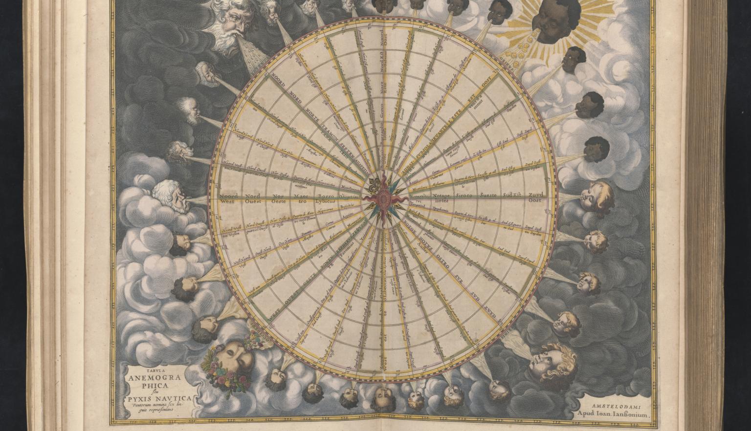
Jan Jansson, Atlantis majoris quinta pars, orbem maritimum : sev omnium marium totius orbis terrarum navigationibus hodierno tempore frequentatorum descriptionem accuratissimam continens Apud Ioannem Ianssonium, Amstelodami, 1657, nla.gov.au/nla.obj-230960868
Jan Jansson, Atlantis majoris quinta pars, orbem maritimum : sev omnium marium totius orbis terrarum navigationibus hodierno tempore frequentatorum descriptionem accuratissimam continens Apud Ioannem Ianssonium, Amstelodami, 1657, nla.gov.au/nla.obj-230960868
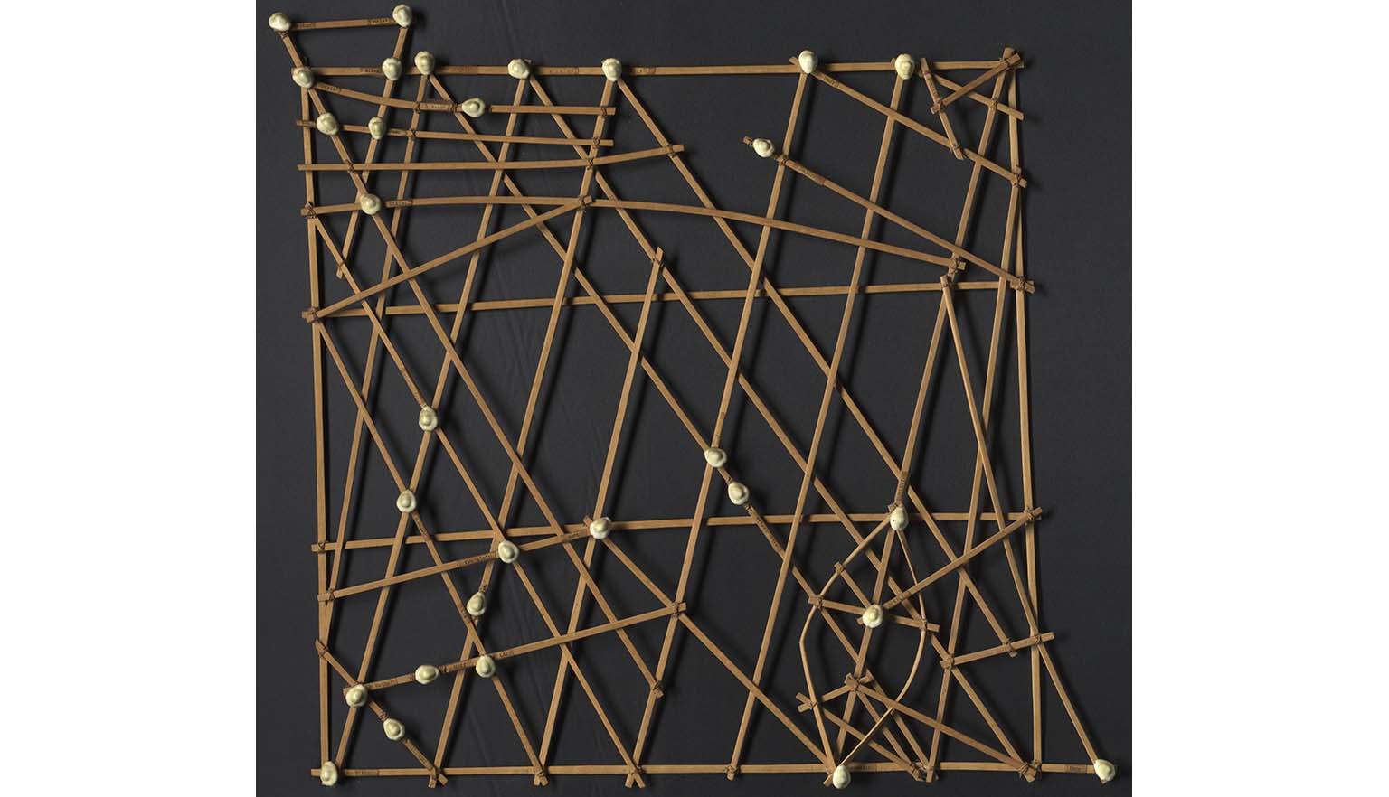
[Stick chart of the Marshall Islands], 1974, nla.gov.au/nla.obj-232466882
[Stick chart of the Marshall Islands], 1974, nla.gov.au/nla.obj-232466882
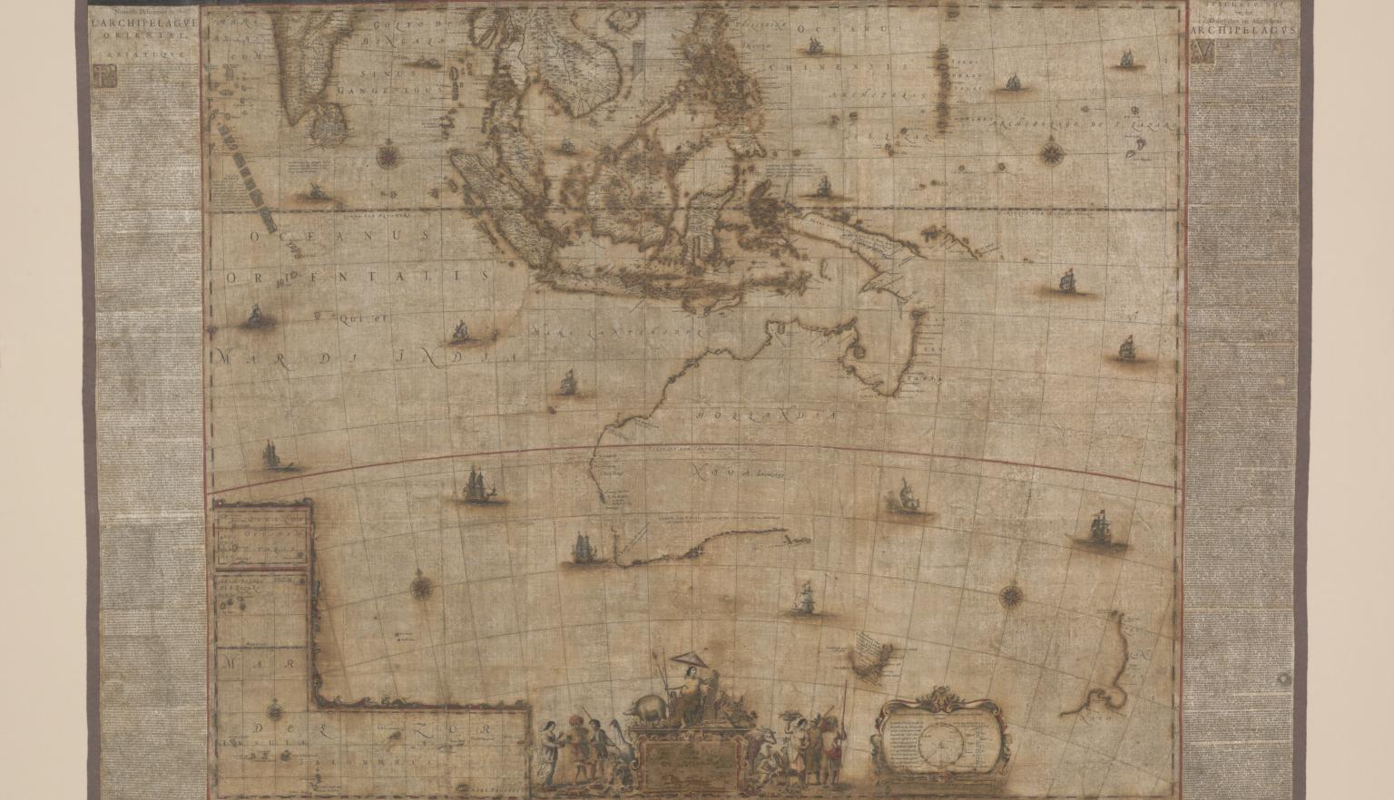
Joan Blaeu, Archipelagus Orientalis, sive Asiaticus Apud Joannem Blaeu, 1663, nla.gov.au/nla.obj-232510007
Joan Blaeu, Archipelagus Orientalis, sive Asiaticus Apud Joannem Blaeu, 1663, nla.gov.au/nla.obj-232510007
Great Britain War Office, [Military survey of Australia], 1914, nla.gov.au/nla.obj-230052045
Great Britain War Office, [Military survey of Australia], 1914, nla.gov.au/nla.obj-230052045
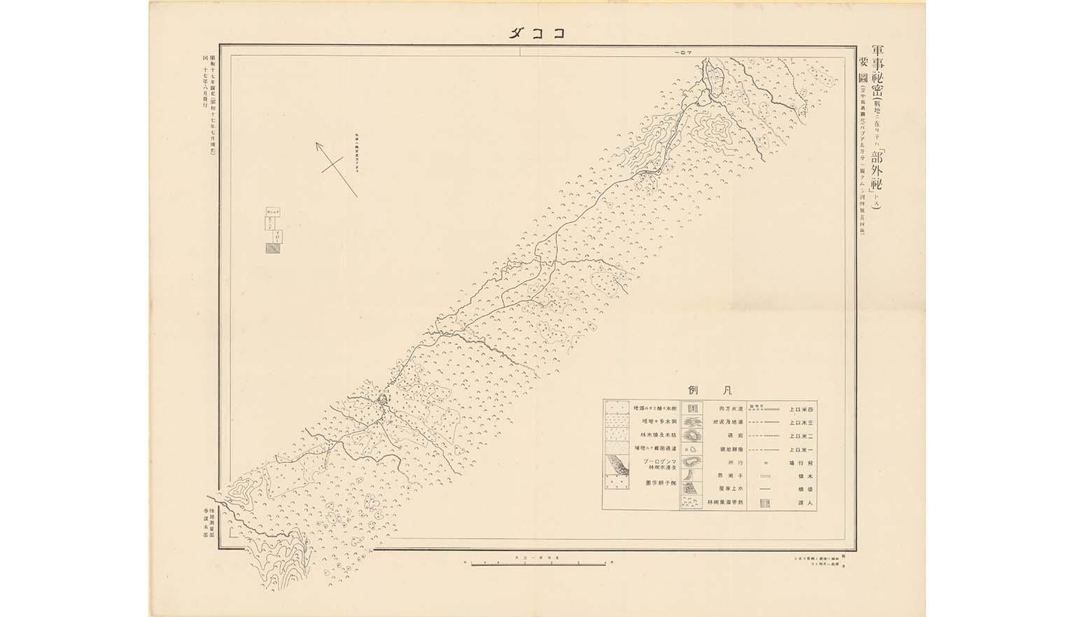
Rikuchi Sokuryōbu, Yōzu Papua gomanbun no ichi zu Kumushi-Gawa, 1942, nla.gov.au/nla.obj-233963374
Rikuchi Sokuryōbu, Yōzu Papua gomanbun no ichi zu Kumushi-Gawa, 1942, nla.gov.au/nla.obj-233963374
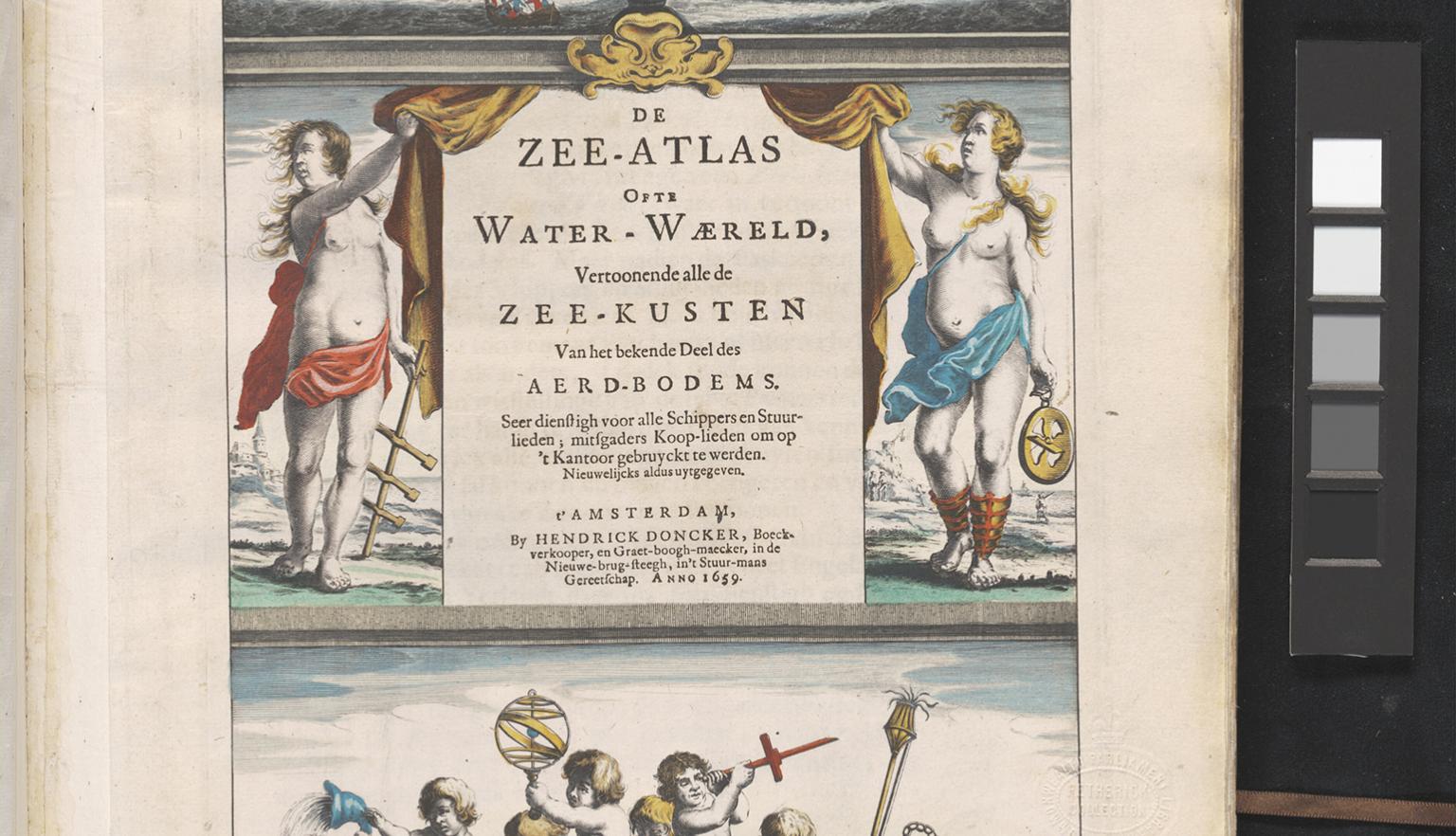
Hendrick Doncker & Claes Jansz Visscher, De zee-atlas ofte water-waereld vertoonende alle de zee-kusten van het bekende deel des aerd-bodems seer dienstigh voor alle schippers en stuurlieden, mitsgaders koop-lieden om op 't kantoor gebruyckt te werden. Nieuwelijcks aldus uytgegeven, 1659, nla.gov.au/nla.obj-230750839
Hendrick Doncker & Claes Jansz Visscher, De zee-atlas ofte water-waereld vertoonende alle de zee-kusten van het bekende deel des aerd-bodems seer dienstigh voor alle schippers en stuurlieden, mitsgaders koop-lieden om op 't kantoor gebruyckt te werden. Nieuwelijcks aldus uytgegeven, 1659, nla.gov.au/nla.obj-230750839
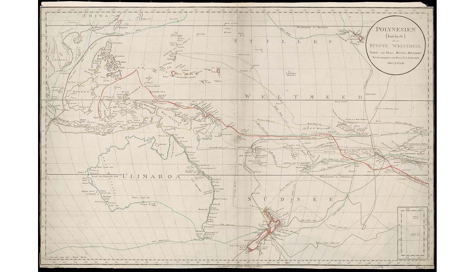
Daniel Djurberg & Ig. K. von Lackner & Franz Anton Schrambl, (1786), Polynesien (Inselwelt) oder der fünfte Welttheil, nla.gov.au/nla.obj-232577705
Daniel Djurberg & Ig. K. von Lackner & Franz Anton Schrambl, (1786), Polynesien (Inselwelt) oder der fünfte Welttheil, nla.gov.au/nla.obj-232577705
Detailed topographic maps prepared by Cartographic Section, Aust. Survey Corps, 1940-1960.
The earliest Dutch charting of the land that became Australia.
British Admiralty charts of Australian waters, 1814-1861
The circumnavigation of Australia.
Plan of Queanbeyan, County of Murray
Plan of the town of Queanbeyan, showing the first Torrens Title purchases.
Real Estate Plans of New South Wales
Part of the immense J. A. Ferguson collection of property maps.
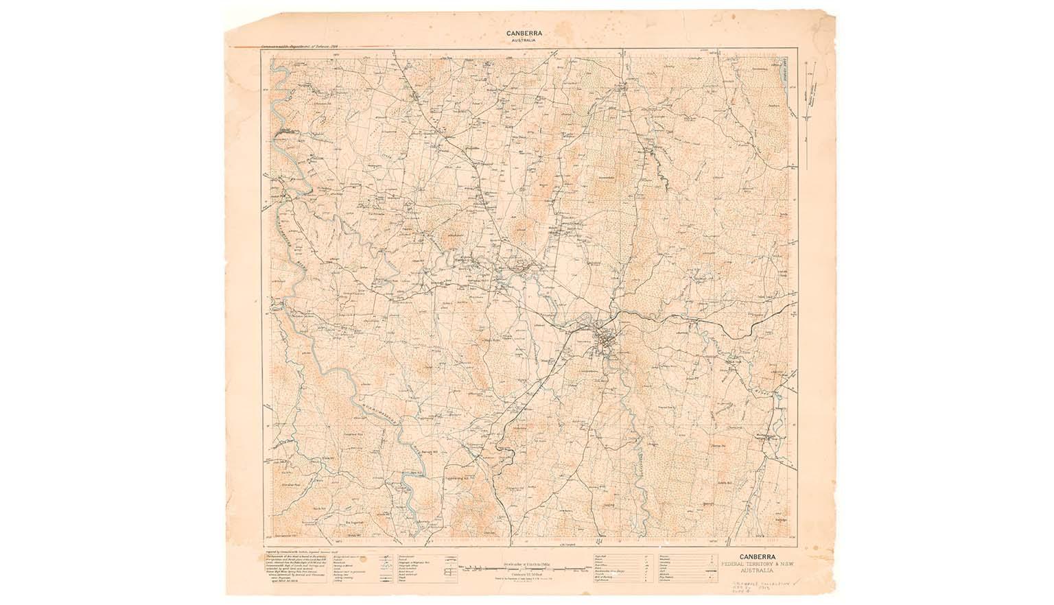
Unravel the fledgling development of our nation's capital with maps illustrating Griffin's vision of Canberra.
Military maps of Gallipoli, Belgium and France, Egypt and Palestine.
An assortment of transport maps, 1850-1950.
Pacific War Japanese military maps
Japanese pictorial maps of Australia, Asia and the Pacific, 1940-45.
Norman B. Tindale's iconic map
Showing the distribution of Aboriginal tribes of Australia.
Charles Raymond Stoddart map collection
Aerial photograph of various cities and locations
The first European atlas of China
The Vlamingh Charts are early 17th-century maps made during Willem de Vlamingh’s voyage, showing some of the first European recordings of Australia's west coast.
The Doncker Atlas is a 17th-century Dutch sea atlas by Hendrick Doncker, known for its clear, detailed maps that guided sailors across the world’s oceans.
Atlantis Majoris is a 17th-century world atlas by Jan Jansson, featuring richly decorated maps that reflected the latest geographic knowledge of his time.
Selected collections
Explore selected highlights from the collection, offering insight into its depth and diversity.
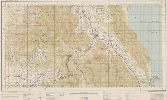
Australia. Army. Topographical Survey Company, 2/1st & Australia. Army. Topographical Survey Company, 6th & Australia. Army. Royal Australian Survey Corps. Gordonvale, Queensland Topographical Survey Company, 1942, nla.gov.au/nla.obj-234344829
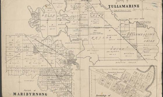
Parish of Tullamarine Parish of Maribyrnong, 1892, nla.gov.au/nla.obj-232027555
More about the Maps collection
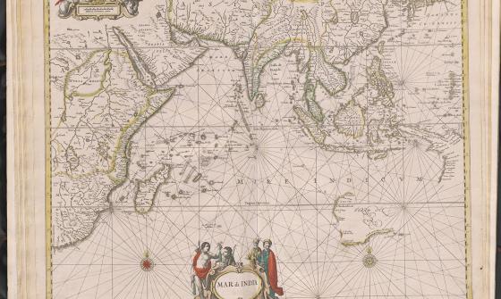
Jan Jansson & Hendrick Doncker, Mar di India, 1659, nla.gov.au/nla.obj-230757141
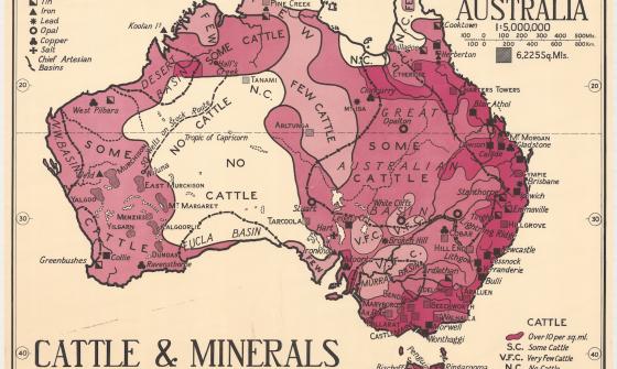
Thomas Griffith Taylor and H. O. Beckit, The new Oxford wall maps of Australia, c.1920, nla.gov.au/nla.obj-255201355