Australian maps for family historians
About Australian maps
The Library holds a range of Australian property mapping useful to family historians and others looking for details of their ancestor’s landholdings or movements at a given time.
Carole Riley's booklet Land research for family historians in Australia and New Zealand is an invaluable resource for family historians seeking to access land title records and maps as part of their research.
Old Title
At European settlement of Australia, land administration followed the British system of ‘Old Title’ whereby information about each parcel of land was held against the name of the owner of the title. Names and extent of these early allotments may be found on early squatting or pastoral maps held by the National Library and most state libraries. Grants and deeds to Old system allotments are held by state land departments or record offices.
Torrens Title
In the 1860’s this system was replaced by ‘Torrens Title’. Torrens Title is a system of recording title information against the parcel of land itself. New South Wales (and other colonies) was divided into counties and parishes. Parish maps, together with village and town surveys, form the basis of land administration. They contain the basic references required to identify the original owner of a parcel of land from the commencement of Torrens Title, and to search for subsequent owners.
The Library holds some early squatting or pastoral maps, showing pastoral runs and localities before Torrens Title, and later. An extensive set of parish and county maps is held for each Australian state (South Australian and Western Australian counties were subdivided into ‘Hundreds’), with particular strengths in the New South Wales/ACT region.
Sales plans (real estate posters) are also held, mainly for NSW, advertising subdivisions from the late 1800s to early 1900s.
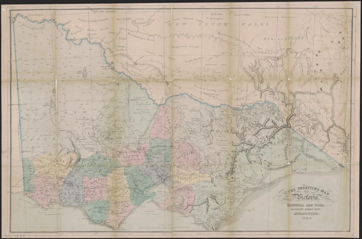
Thomas Ham, Blundell and Ford, The squatting map of Victoria, 1864-1865, nla.gov.au/nla.obj-231392173
Thomas Ham, Blundell and Ford, The squatting map of Victoria, 1864-1865, nla.gov.au/nla.obj-231392173
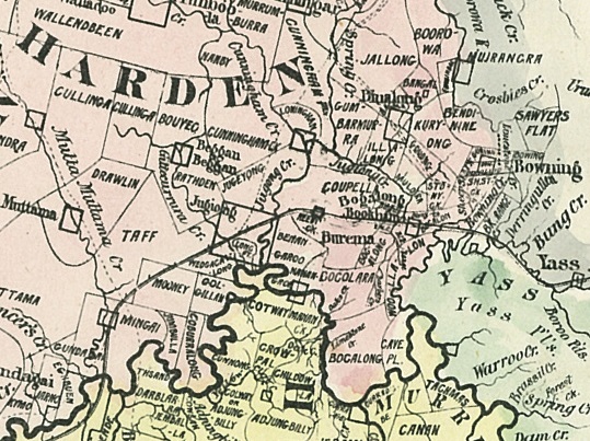
Pastoral or squatting maps
There are many maps which show the location of pastoral runs, stations and squatting ‘runs’ for pastoral properties. Use these to find maps relating to ownership before Torrens Title and for identifying large pastoral runs. Most can be viewed online, others can be viewed at the Library.
1. Search the Library’s catalogue
Enter the relevant state name and pastoral or squatting (e.g. "New South Wales" AND pastoral OR squatting) into the search bar for the catalogue and search. Review the catalogue results and use the filters on the right-hand side to select “Map” for format. Date sort the results (oldest to newest).
2. Identify a pastoral property
Most of the early pastoral maps have been digitised. Zoom in on the map to identify pastoral properties.
3. Request to view the map at the Library
You will need a Library membership to access our special collections materials in-person. Applying for a free Library membership allows you to request collection items to use in the Library, and provides access to a wide range of eResources from home.
If the map is not digitised, it can be requested to view in the Library. To request a map, scroll down the catalogue record, "Select" the item, log in to your account and proceed to confirm your "Request".
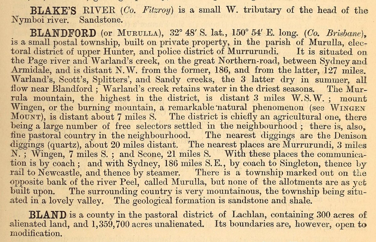
4. Consult Bailliere’s gazetteer
Many localities and pastoral stations are referred to and described in Bailliere’s gazetteers, published for each colony in the 1860s and 1870s. These are available on request via the catalogue (e.g. “New South Wales” AND Bailliere’s gazetteer).
Bailliere's gazetteers for New South Wales, South Australia, Queensland and Tasmania have all been digitised and are available online from the Library of Congress.
Parish, town and country maps
To find parish and county maps relating to ownership from Torrens Title onwards, and to obtain title information from Lands Departments, see Using parish, town and county maps.
Parish maps were used by Lands Departments to register all land holdings, show boundaries, land use and types of ownership. Many can be viewed online, others can be viewed at the Library.
In addition to being a starting point to finding property related records at Lands Departments, they show the size and position of properties, and other useful geographical information.
1. Locate the parish.
For NSW and most other states, all place names are recorded against a parish, within a county. The most comprehensive gazetteer for NSW and ACT is the 'List of place names in New South Wales' by Gleeson (1954). It is available in the Library's reference collection, or may be consulted online at the Geographical Names Board of NSW.
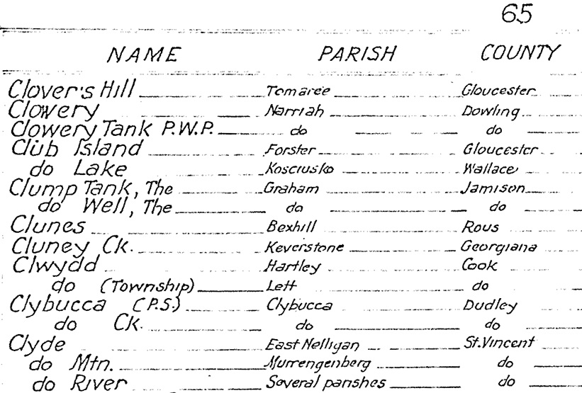
Detail from E. C. Gleeson "List of localities in New South Wales", 1954, MAPGZ NSW 1954.
Not NSW/ACT?
The National Library has county and other land district maps for all Australian states. To help identify the relevant land district map (county, parish etc), on which your place of interest is located, Wikipedia provides a list of administrative divisions of Australia, including maps, for each state. If you are working on-site at the Library, you may also find our collection of state-based gazetteers (listings of place names) useful. Ask staff in the Special Collections Reading Room for assistance.
2. Search for the parish (or hundred, county)
Once you've identified the land district covering your place, enter the name, e.g. "parish of Keverstone", into the search box, and select "Map" from the dropdown menu for format. County maps show all the parishes (or hundreds) located in a particular county, and are useful to identify adjacent parishes.
To request a county map, enter the county name, e.g. "county of Georgiana", into the search box, and select "Map" from the dropdown menu for format. Sort the results by Title (A-Z) to separate county maps from parish maps.
3. Identify the allotment and titleholder
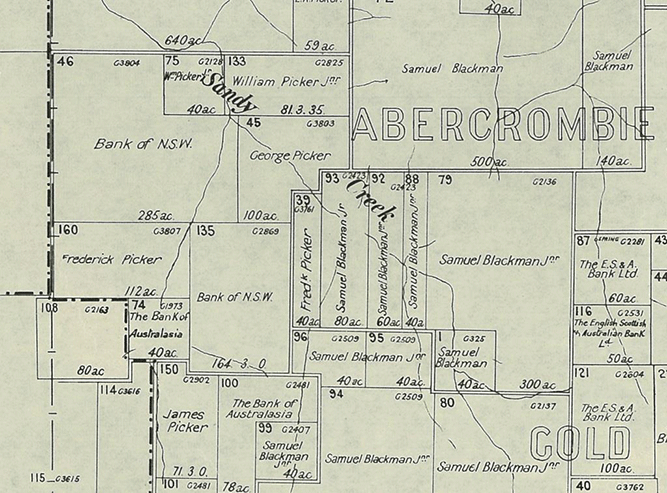
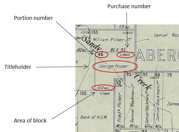
Most NSW parish maps have been digitised. Zoom in on the parish map to identify the titleholder's name and portion number, and a purchase reference number. Also indicated on each portion is its area in acres, roods and perches.
4. Town maps
Villages and towns were also surveyed and maps drawn up to show the first title holders of smaller town blocks. The Library holds a large collection of town maps for NSW and other states. To search for maps of towns, search on the name of the town (e.g. "town of Kiandra") and select "Map" from the dropdown menu for format. Note that that the names of some towns have changed over time.
More detailed deposited plans of towns and suburbs (including Sydney) are available from the Land Registry Services NSW Historical land record viewer.
5. Request Historical title search
The names that appear on each portion on parish or town maps are generally the first titleholder. In some cases names may change on later editions of parish maps where land became subject to a mortgage, or if land was resumed by the Crown, or became subject to soldier settlement purchase etc.
If you wish to follow the trail of land ownership for NSW property, Land Registry Services NSW provides a range of services on its Historical research page. The parish map provides references essential to requesting a history of title search from LRS. For example, the portion number 45 allotted to George Picker above, has a purchase number of 'G3803'. More information about researching land titles in NSW is available through the LRS's Search Guides.
For other states, please contact your local lands department for further advice.
Real estate or sales plans
Sales plans were used by real estate companies to advertise land sales (both those that occurred and some that did not progress further than the plan). They contain evidence of prices paid for suburban blocks, boundaries, road changes, land use, social change and types of ownership. Many can be viewed online, others can be viewed at the Library.
The National Library’s collection of 10,000 sales plans records the real estate auctions of eastern Australia, including Sydney, and the subdivision of vast tracts of land, from the 1840s – 1930s.
Finding sales plans
Visit the Library's catalogue.
Enter “sales plan” AND a place, town or suburb name into the search box, and select search. Select “Map” from the dropdown menu for format.
To view only digitised maps, enter “sales plan” AND a place, town or suburb name into the search box, select "Map" as the format, and select “digitised item” under the Access filter.
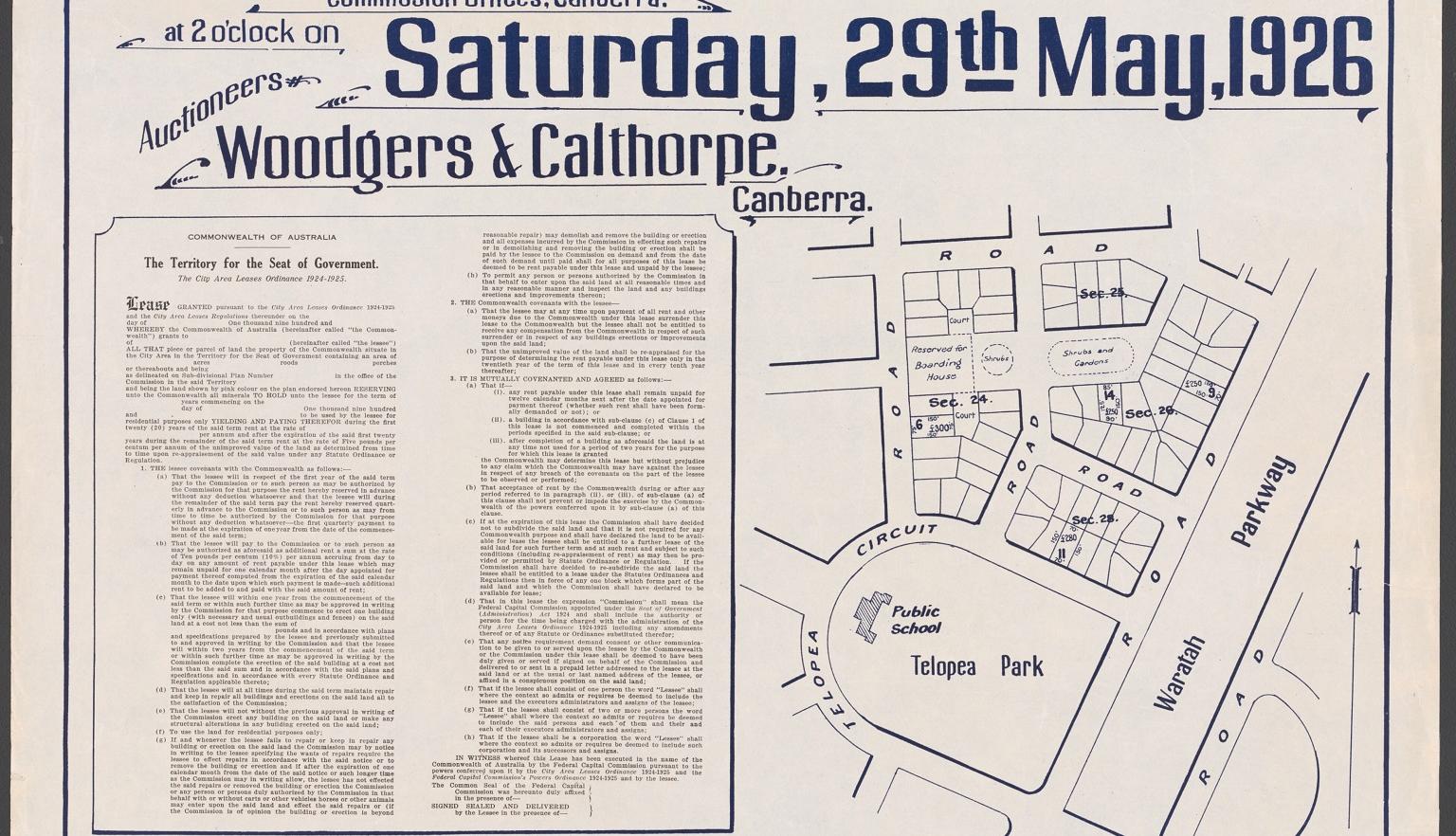
Australia. Federal Capital Commission & Woodgers & Calthorpe Ltd, Residential sites Canberra Federal Territory, Telopea Park, subdivision, 1926, nla.gov.au/nla.obj-232879045
Australia. Federal Capital Commission & Woodgers & Calthorpe Ltd, Residential sites Canberra Federal Territory, Telopea Park, subdivision, 1926, nla.gov.au/nla.obj-232879045
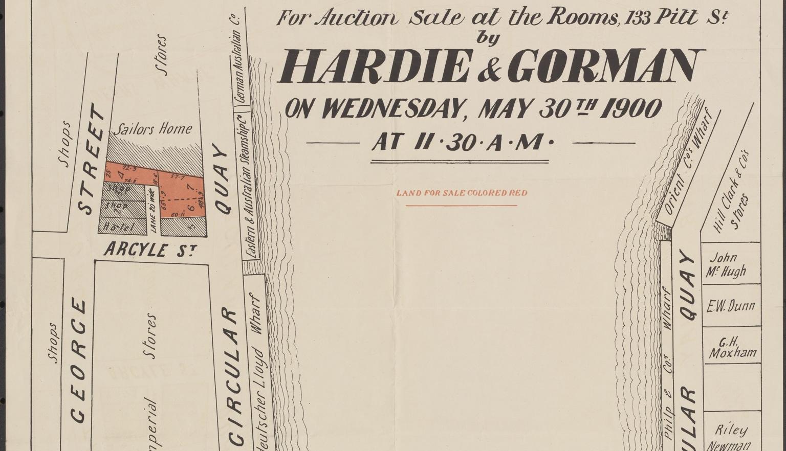
Hardie & Gorman Pty. Ltd & W. E. Smith Ltd, Circular Quay and George St., a splendid site for stores and offices, opposite the wharves for auction sale at the rooms, 133 Pitt St, nla.gov.au/nla.obj-230508873
Hardie & Gorman Pty. Ltd & W. E. Smith Ltd, Circular Quay and George St., a splendid site for stores and offices, opposite the wharves for auction sale at the rooms, 133 Pitt St, nla.gov.au/nla.obj-230508873
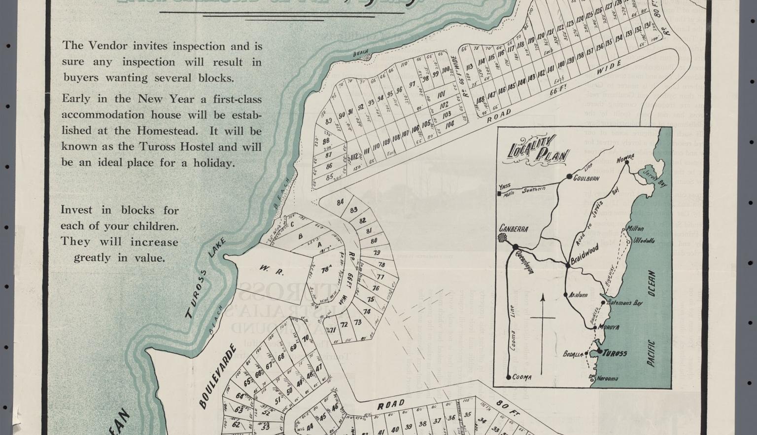
Busyby Hardy & Norman & McWilliam, H. R & W.C. Penfold & Co. Tuross between Bodalla & Moruya for private sale H.R. McWilliam, Property Salesman, 1924, nla.gov.au/nla.obj-229906993
Busyby Hardy & Norman & McWilliam, H. R & W.C. Penfold & Co. Tuross between Bodalla & Moruya for private sale H.R. McWilliam, Property Salesman, 1924, nla.gov.au/nla.obj-229906993
Where else to look
We may not hold historical property mapping or records for your area and/or time period of interest.
If this is the case, you may be able to access maps and historical property information from other sources. All state libraries and some regional libraries include map collections comprising historical property mapping, real estate plans and so on. Many maps are catalogued onto Trove, the Australian online search and discovery service.
Other libraries and property departments have created guides to their map, land or plan collections. These include:
Historical maps
- NSW Parish Maps
- City of Sydney Archives: Historical Atlas of Sydney
- Historical maps and plans Queensland
Place names
- ACT Place names
- Alphabetical list of place names NSW
- Geographical Names Board of New South Wales: Place Name Search
- Gazetteer of Australian Place Name Search: Geoscience Australia
- Landgate: Western Australian Place Names History
- Northern Territory Place Names Register
- PlaceNames Online: South Australian State Gazetteer
- Placenames Tasmania
- Queensland Place names
- VICNAMES: The Register of Geographic Names
Other Library guides
Continue your journey


Conor Ashleigh, Bridal couple Achol and Marial and their bridal party, Sydney, December, 2013, nla.gov.au/nla.obj-506867692
More to explore
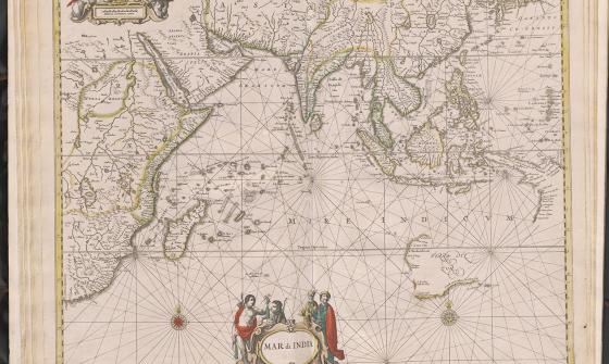
Jan Jansson & Hendrick Doncker, Mar di India, 1659, nla.gov.au/nla.obj-230757141
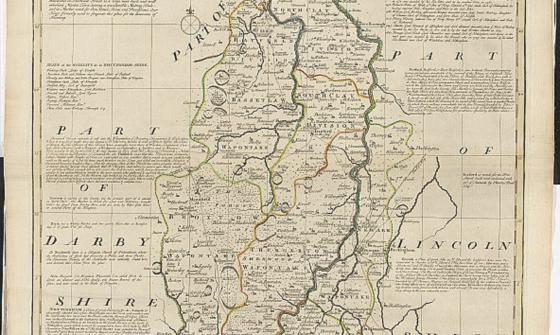
The large English atlas, or, A new set of maps of all the counties in England and Wales, 1785, nla.gov.au/nla.obj-230779636